About
About
Ocean Dynamics Laboratory
People in the Ocean Dynamics Laboratory are interested in understanding how the oceans work. Heat goes in (and out), fresh water and different chemicals are added (and subtracted), and resulting changes in density create pressure gradients that drive currents - which are in turn modified by the tidal effects of the moon, the spin of the earth, and friction against the solid boundaries. We make ocean measurements and use math to interpret and understand these measurements in terms of fundamental fluid dynamical laws. Also, we tend to specialize in the coastal waters of British Columbia, which have an amazing variety of interesting and important processes to study.

Projects
Projects
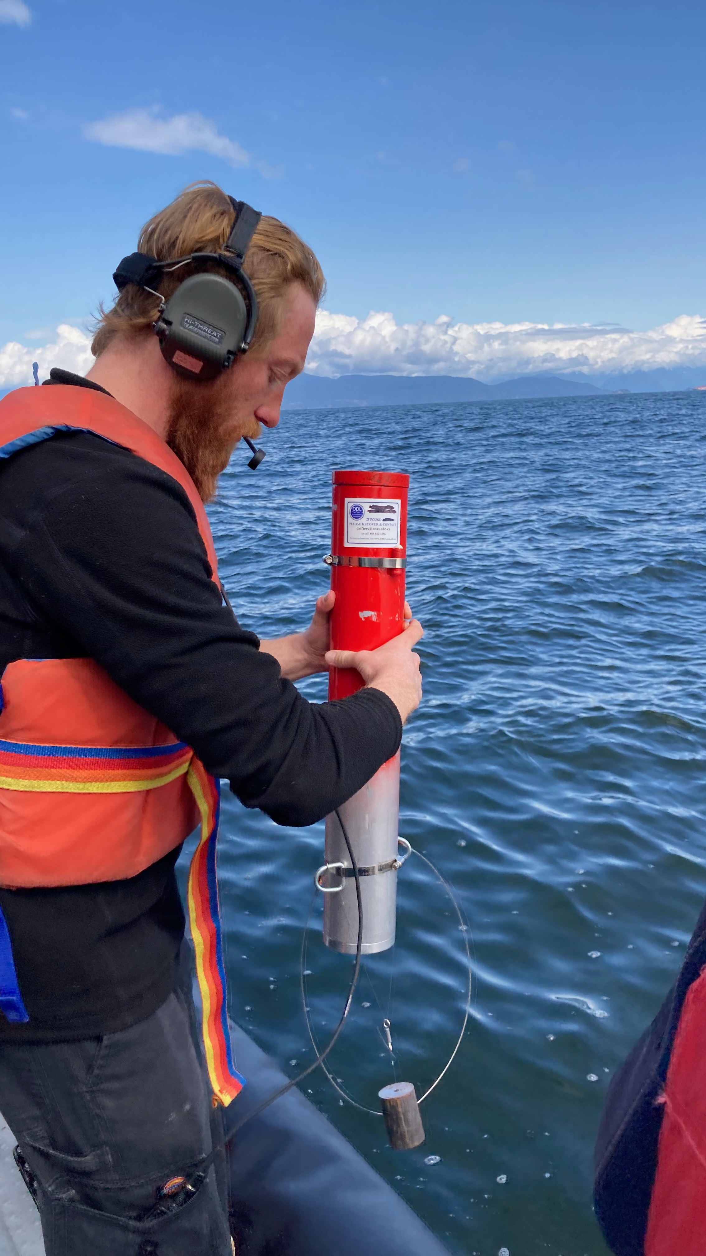
Lagrangian Studies of Ocean Circulation ("The Drifter Project")
As oceanographers, we are interested in understanding where floating things in the ocean (which includes fresh water from rivers) actually go.
For example, in the Strait of Georgia, an enormous amount of fresh water is brought in by the Fraser River. This fresh water then mixes with the salty ocean water in the Strait, and EVENTUALLY flows out into the Pacific Ocean, mostly (we think) past Victoria and down Juan de Fuca Strait. Along the way, this fresh(er) water outflow also takes with it all of dissolved substances that are already in the Fraser – agricultural nutrients, discharged sewage, sediment, and other things like logs.
But how exactly does this fresh water get to the Pacific? And how long does this take? And what about all the logs washed up on beaches? We already know that the surface water in the Strait of Georgia is moved around by the wind and tide, but what we don’t know is just how important these factors might be overall in setting the actual circulation.
We are approaching this problem by releasing TRACKED drifters. As these make their way to wherever they go, we get a continuous track of their location through a satellite telemetry system. From this track we can determine how fast as well as how far they go, and learn a lot more about turbulence in the circulation in the Strait as well.

Atlas of Oceanographic Conditions in the Strait of Georgia
https://sogdatacentre.ca/atlas/
The Atlas of Oceanographic Conditions in the Strait of Georgia is based on the Pacific Salmon Foundation's Citizen Science Dataset. The "PSF CitSci" Program visits about 60 locations in the Strait roughly 20 times a year to measure a variety of ocean properties, resulting in around 1000 stations sampled every year. Additional information in the atlas comes from stations sampled by the Hakai Institute in the far northern Strait of Georgia, the T'Sleil Waututh Community Fishers program in Burrard Inlet, and the zooplankton archive of Fisheries and Oceans Canada.
Oceanographic information about the Strait of Georgia in this atlas is divided into different sections concentrating on Hydrography (temperature, salinity, dissolved oxygen content, and total chlorophyll), Nutrients (the major macronutrients that support plant life in the Strait), Harmful Algae, and Zooplankton.
Thermodynamic Equation Of Seawater - 2010 (TEOS-10)
Learn about the project: https://www.teos-10.org/
Read the preface article: https://os.copernicus.org/articles/special_issue14.html
Marine Environment Observation Prediction and Response (MEOPAR)
Established in 2012 through Canada's federal Networks of Centres of Excellence Program, the Marine Environmental Observation Prediction and Response (MEOPAR) Network is a national network of academic researchers and students, government scientists, and partners in the private, NGO and community sectors working together to reduce vulnerability and strengthen opportunity in Canada's marine environment. Our primary activities include:
- Supporting interdisciplinary research and development at Canadian universities
- Providing training and work experience to bolster Canadian workforce capacity
- Mobilizing scientific knowledge, technology and people through cross-sector engagement
Contaminant Dispersal in the Strait of Georgia and Salish Sea
Electrical conductivity and other properties of natural waters
Working in lakes and the ocean got me interested in trying to understand how these water conduct electricity. This may seem a bit odd, but in fact the electrical conductivity is proportional to the amount of dissolved ions in the water. In fact, measurements of conductivity are the primary (and often only) way that oceanographers and limnologists have to describe the salt content. But no-one really knows how to predict the conductivity for a given chemical composition - until [Pawlowicz, Limnology and Oceanography:Methods, 2008] which describes a numerical I model I wrote to do this.
This work has gotten me involved in SCOR Working group 127, and part of the team developing the new international Thermodynamic Equation of Seawater (TEOS-10) , now THE accepted method for the estimation of the properties of seawater!
Coastal Mixing Processes - Bulk Flow, Mixing, and Mass Fluxes
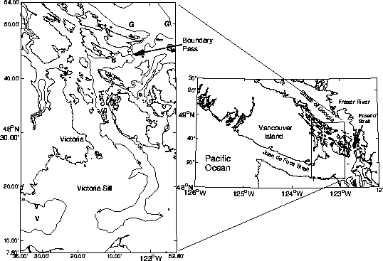
The Straits of Georgia and Juan de Fuca form a large estuary on the west coast of Canada. Fresh water from river runoff, primarily from the Fraser river, flows out into the Strait and forms a large, thin buoyant layer only a few meters thick. This plume then flows out towards the Pacific, passing through a small band of islands between the two Straits. These islands are called the Gulf Islands in Canadian Waters, and the San Juan Islands in US waters. Depths in the Strait of Georgia reach 400m, whereas those in the Straits of Juan de Fuca are closer to 200m. Within Haro Strait and Boundary Pass, the major channel through the Gulf Islands, are two shallow areas (or "sills") with depths of about 100m, separated by a deeper region (depth 400m).
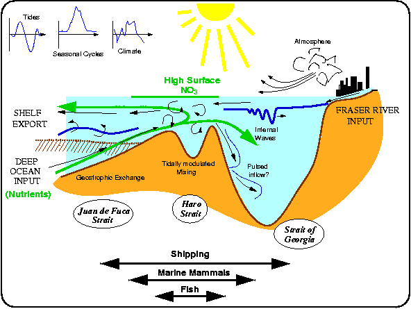
As the surface waters move seaward, they mix with the salty waters below (as shown in the schematic figure above). Thus there is a net seaward flow of salt in the upper waters. In a steady state system there must then be an inflow of salt in the deeper waters. Over most of this region, we can see evidence for this two-layer flow pattern. Note that the because of the mixing, the amount of water actually moving in either of the two layers is much greater than than flowing in the rivers which drive the circulation. How much more is difficult to say - but the ESTUARINE AMPLIFICATION factor is probably 10-20.
To really understand what this amplification factor is (and why), we have to understand the processes of mixing. There are different kinds of mixing - we need to understand things like where, and how much, and when it occurs. Much of the mixing happens in the Gulf Islands region. But should we consider the islands to act as a kind of "egg-beater" as the tides slosh water back and forth? Should we rather think of the mixing as being driven by bottom turbulence? Or is something else important? The bathymetry is dominated by two sills; this has led to speculation that a physical process known as hydraulic control(and the turbulence generated in the hydraulic jumps downstream of the control) may be important.

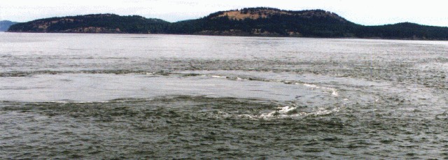
These are important questions. Unfortunately, they are also difficult to approach directly. The intense turbulence that occurs in this region manifests itself on many scales. This picture shows a ``boil'' some 20m across occuring at the meeting of two streams as they join in the lee of an island. Such features are sometimes powerful enough to spin large ships around, and their time scale is measured in minutes! Because of this variability direct measurements (e.g. from current meters) are not necessarily useful for understanding the larger scales (for more information about what causes these boils see Farmer, Pawlowicz, and Jiang, Dynamics of the Ocean and Atmosphere, 2002).
To look at the big picture new ideas are called for!
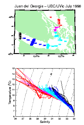
 During a field program in 1996, I noticed that plots of temperature vs. salinity for the waters in this region showed an interesting curved nature. A simple mixing process would result in a straight T/S correlation. Analysis of this data [Pawlowicz and Farmer, J. Geophys. Res. , 1998] indicates that this curved nature arises from the effects of surface heating, and gives us a handle on trying to estimate bulk mixing rates. In the summer of 1998 I went back into the field to get more data on this effect, and to extend the results over a wider area. The figure at right shows the results. Individual vertical profiles are colour-coded from red (Strait of Georgia) to black (near the mouth of Juan de Fuca Strait). Notice that the slope of the black curves is steeper than the red ones. Using this data as well as some mathematical theory developed for this problem calculated the average in- and out-flow at various points in this region, as well as estimates of bulk mixing [Pawlowicz, Estuarine Coastal and Shelf Sciences, 2001].
One exciting application of this work is to determine the fluxes of other materials - for example, the flux of nutrients. Currently we are trying to use this approach to get a better idea of what the seasonal changes are, and by measuring nutrients (nitrate, silicate, and phosphate) attempting to better understand changes in these biologically important parameters. During 2002-2006 I was one of the primary investigators in the Strait of Georgia Ecosystem Monitoring Project (STRATOGEM) [Pawlowicz, Halverson and Riche, Atmosphere-Ocean, 2007].
 Recently this has has gotten me involved in a large multi-investigator project, the Rivers Inlet Ecosystem Study , in remote Rivers Inlet, BC, where we are trying to understand just why the salmon have stopped coming into what was until about 20 years ago the 3rd largest run of sockeye salmon in British Columbia.
Internal Tides and Mixing
Acoustic methods have shown great promise in making rapid and accurate measurements of currents. The Acoustic Doppler Current Profiler (ADCP) is a new instrument especially developed for oceanographic use. It allows the almost instantaneous measurement of currents from the surface down to the bottom some 400m away. A complete three-dimensional view of the flow field can now be obtained as fast as a ship can travel. I hope to use data from such an instrument to quantify both the mean and turbulent parts of the flow field, exploring the region to map and understand mixing and internal soliton and bore processes.

Here's an example, from data collected during the Haro Strait Experiment. The upper panel shows backscatter from a 100kHz echosounder over a period of about 1 hour as we transit an area of boils. The red plumes projecting downwards represent intense concentrations of bubbles sucked down to 100m below the surface.The second panel shows temperatures, measured by to-yo-ing a CTD. These bubble plumes are associated with warm surface water (orange and red colours). The lowest panel shows vertical velocities measured using an ADCP, with red for upward and blue for downward velocities. Vertical velocities are greater than 50 cm/s in the intense plume at the center of the strip, a very large number indeed!![]() Recently, using a simple linear analysis, [Pawlowicz, JGR, 2002] I found an internal tide of amplitude 1 m/s in velocity and 40m in height in Haro Strait. I am very excited by this - you don't often get such simple explanations for what looked like a very complicated set of observations. However, the amplitude of the wave is big enough that nonlinrear effects must be important. The picture at right shows an ADCP transect down through the crest of this internal tide. It doesn't look like much, but in fact it is telling us that a fascinating phenomenon called an internal hydraulic drop is occurring.
Recently, using a simple linear analysis, [Pawlowicz, JGR, 2002] I found an internal tide of amplitude 1 m/s in velocity and 40m in height in Haro Strait. I am very excited by this - you don't often get such simple explanations for what looked like a very complicated set of observations. However, the amplitude of the wave is big enough that nonlinrear effects must be important. The picture at right shows an ADCP transect down through the crest of this internal tide. It doesn't look like much, but in fact it is telling us that a fascinating phenomenon called an internal hydraulic drop is occurring.
Flow visualization using Time-Lapse Photography
Many of these complicated subsurface features have a surface expression - like the boil shown above. In order to get a better understanding of the shape an evolution of such features I have begun experimenting with time-lapse photography.
It turns out that there are all kinds of interesting things occurring in Haro Strait! Clicking here or on the still image at left will let you see a 2Mb MPEG movie of features near the southern end of Haro Strait in July 1999 (Note - you need a full mpeg viewer to correctly view this movie). The original images taken over a 7 hour period have been rectified onto a map; the green line shows the SW coast of San Juan Island and the magenta lines are the 250m isobaths on either side of the deep channel. Tidal elevation and currents are shown at right. Note the internal waves propagating across the Strait (diagonal dark lines moving towards the upper right) near slack water, followed by a northward-travelling "bore" near the coast during the flood tide. Thick fast-moving streaks are freighters, thin streaks are smaller craft.
 Currently Caixia Wang (Ph.D. Candidate) is trying to use this system to understand the dynamics of internal wave propagation in the Strait of Georgia. The thumbnail at left shows an aerial photo taken from 500m looking down at an internal wave packet. Although internal waves are waves on a deep density interface, they can be seen from the surface because they change the surface waves overhead (making rough and smooth patches which you can see in the upper part of the photograph, or because the water in them is a different colour - the green lines at the bottom of the photograph). The red dot at center left is the Coast Guard Hovercraft SIYAY (length 30m) , outfitted with a CTD to measure temperature/salinity/density profiles, as well as an Acoustic Doppler Current Profiler (ADCP) to measure currents associated with these waves. If you click on the image you can see the internal waves much more clearly.
 In 2007 I was part of cruise to Knight Inlet, where I made many more cool movies of internal waves being formed on the famous sill there.
Lake Dynamics
 Lakes aren't oceans, but some of the lakes in the interior of British Columbia can get pretty big. Working with R. Pieters of the Environmental Fluids Lab we have been
studying the dynamics of Harrison Lake, which is 60km long and almost 300m deep. The inflowing Lillooet River at the northern end has a strong turbidity signal which can slowly be tracked down the lake through summer months.
Following this study, we investigated anoxic Nitinat Lake on the West Coast of Vancouver Island (which, despite its name, is actually a fjord filled with seawater). In collaboration with B. Laval (UBC Civil Eng.) and S. Baldwin (UBC Chem and Biological Eng.) we discovered how this fascinating system, which is 200m deep with deadly anoxic water coming as close to the surface as 3m in late summer (and, paradoxically, is the site of the largest chum salmon hatchery in Canada) "works" [Pawlowicz et al., Limnology and Oceanography, 2007].
More recently, I have been working in Powell Lake. Powell Lake looks normal enough on the surface, and is about 50m above current sea level. However, it contains seawater at the bottom of two of its basins. This seawater was trapped after the coastal land mass rebounded upwards at the end of the last ice age about 10,000 years ago. This ancient seawater is filled with various gases (water samples "fizz" like very smelly champagne), and geothermal heat which result in double-diffusive layering at depth.
Strait of Georgia Project
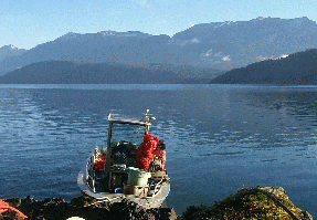
 This is a project we have started at UBC to try and understand the coupled biology and physics of the Strait of Georgia and there is far more to say about it than I want to type here (but you can see Shannon and Carla doing chemistry on the back deck of the hovercraft at left - hope they don't turn that fan on!). For more details see the Strait of Georgia Project Web page, www.stratogem.ubc.ca.
Spring 2005...48 sampling trips into the Strait of Georgia and DONE!....data summary seen at right:
Our Team
Our Team

Rich Pawlowicz

Shumin Li

Grace Watts
Currently I have a number of different research interests, mostly based in the beautiful and fascinating waters around British Columbia. The deep fjords and many islands provide many interesting oceanographic problems and the dynamics of the region are immensely important to the people of BC for both economic and social reasons.
The approach taken towards understanding these problems is to combine complex fieldwork with careful mathematical analysis at my desk (think of it as brawn and brains). I go to sea in ships ranging in size from the 7m department whaler to the 80m CCGS J. P. Tully (and sometimes fly above the sea in small planes and helicopters). As well as using standard techniques for sampling the ocean temperature and salinity I am also actively developing new methods for flow visualization using acoustics and optics.
Past Members
Research Associates
- M. Halverson (2013-2017)
- Romain di Constanzo (2015-2017)
- Katia Stankov (2017-2022)
PostDoc
- Randall Lee (2002-2004)
- Mina Masoud (2020-2023)
Graduate Students
- Mark Halverson (Ph.D. 2003-2009)
- Caixia Wang (Ph.D. 2002-2009)
- Mike Hodal (M.Sc. 2008-2011)
- Olivier Riche (Ph.D. 2004-2011)
- Ben Scheifele (M.Sc. 2011-2013)
- Chuning Wang (M.Sc. 2012-2015)
- Artem Zaloga (M.Sc. 2013-2016)
- Lan Li (Ph.D. 2018, visiting from Ocean University of China 2017-2018)
- Sam Stevens (Ph.D., 2017-2024)
- Nik Simantiris (M.Sc., 2017-2019)
- Mina Masoud (Ph.D, visiting from Tehran University, 2017-2019)
- Ed Mason (M.Sc., 2019-2022)
- Shumin Li (M.Sc., 2019-2022, PhD., 2022-)
- Nicole Mcewan (M.Sc., 2019-2022)
- Li Wang (Ph.D., visiting from Wuhan University, China, 2019-2021)
- Wu Fan (Ph. D., visiting from Ocean University of China 2022-)
- Grace Watts (M. Sc., 2023-)
Undergraduate Students
- Darren Thomson (summer 2002)
- Amber Kelter (fall/winter 2002/3)
- Kyla Drushka (summer 2004)
- Marianne Jensen (2004-2005)
- Megan Wolfe (2005-2006)
- Melissa Rohde (summer 2006)
- Adrian Jones (2010-2011)
- Marianne Williams (summer 2011)
- Tara Howatt (fall 2012)
- Janet Lam (summer 2016)
- Kevin Fan (winter 2017)
- Vahid Dehghanniri (2017, volunteer)
- Emily Tyhurst (summer 2017)
- Nicholas Larsen (summer 2017)
- Forbes Choy (winter 2018)
- Reese Chappel (summer 2018)
- Andrew Ta (fall 2018-2020, volunteer)
- Iris Gao (winter 2019)
- May Wang (summer 2019)
- Natasha Moysiuk (summer 2019)
- Trent Suzuki (winter 2020)
- Isabelle Lao (winter 2020, volunteer)
- Brianne Boufford (winter 2021)
- Lavanya Kandhari (winter 2022)
- Elli Cunningham (summer 2022, fall/winter 2022/2023)
- al Rahim Houssein (winter 2023)
- Ben Humer (summer 2023)
- Winnie Wen (fall 2023)
- Ellie Hu (winter 2024)
- Nickson Mak (fall 2024)
- Griffon Hoeven (winter 2025)
Publications
Publications
2025
S. Li and R. Pawlowicz, 2025, Tidal Modulation of the Fraser River Plume, J. Geophysical Research, 130, e2024JC021432, https://doi.org/10.1029/2024JC021432
2024
S. Esenkulova, R. Pawlowicz, N. Fredrickson, I. Pearsall, Oceanographic conditions and harmful algal blooms in the Strait of Georgia 2023, pg. 210-216 in Boldt, J., Joyce, E., Tucker, S., Gauthier, S., and Dosser H. (Eds.). 2024. State of the Physical, Biological and Selected Fishery Resources of Pacific Canadian Marine Ecosystems in 2023. Can. Tech. Rep. Fish. Aquat. Sci. 3598: viii + 315 p.
L. Wang, R. Pawlowicz, W. Ai, P. Covert, Wind and river effects on a coastal current in Chatham Sound, British Columbia. 2024, Estuarine, Coastal and Shelf Science, https://doi.org/10.1016/j.ecss.2024.108966
S. Stevens, R. Pawlowicz, T. Tanhua, L. Gerke, W. A. Nesbitt, A. Drozdowski, J, Chasse and D.W.R. Wallace, 2024, Deep inflow transport and dispersion in the Gulf of St. Lawrence revealed by a tracer release experiment, Communications Earth and Environment 5, 338, https://doi.org/10.1038/s43247-024-01505-5
Beutel, B., & Stevens, S. W., 2024. Discovering DIY oceanography: building floats to track deep ocean currents. Science Activities, 61(4), 194–206. https://doi.org/10.1080/00368121.2024.2376753
R. Pawlowicz, C. Chavanne, and D.Dumont, 2024, The Water-Following Performance of Various Lagrangian Surface Drifters Measured in a Dye Release Experiment, J. Atmospheric and Oceanic Technology, 41, 45-63, https://doi.org/10.1175/JTECH-D-23-0073.1
2023
M. Masoud and R. Pawlowicz, 2023, Tidally-modulated turbidity and density fluctuations in a rotationally-modified gravity current, J. Geophy. Res., 128 (12), e2023JC019909, https://doi.org/10.1029/2023JC019909.
R. Pawlowicz and R. Yerubandi, 2023, Water as a Substance, Chapter 2, Wetzel: Limnology, 4th edition, editors J. Smol and I Jones, Elsevier, https://shop.elsevier.com/books/wetzels-limnology/jones/978-0-12-822701-5
S. W. Stevens, R. Pawlowicz, 2023, Swish floats: an inexpensive neutrally buoyant float to monitor dispersion in coastal seas, J. Atmospheric and Oceanic Technology, 40, 1493-1508, https://doi.org/10.1175/JTECH-D-23-0045.1
S. Esenkulova, R. Pawlowicz, N. Fredrickson, I. Pearsall, Oceanographic conditions and harmful algal blooms in the Strait of Georgia 2022, pg. 209-214 in Boldt, J., Joyce, E., Tucker, S., and Gauthier, S. (Eds.). 2023. State of the Physical, Biological and Selected Fishery Resources of Pacific Canadian Marine Ecosystems in 2022. Can. Tech. Rep. Fish. Aquat. Sci. 3542: viii + 312 p.
Y. Gong, L. Li, R. Pawlowicz, S. Cai, 2023, Numerical Investigation on the Generation and Evolution of Nonlinear Internal Waves in the Southern Strait of Georgia. Progress in Oceanography, 215, July 2023, 1030503, https://doi.org/10.1016/j.pocean.2023.103053
N. McEwan, R. Pawlowicz, E. Pakhomov, and M. T. Maldonado, 2023, Seasonality of modelled planktonic food web structure in the Strait of Georgia, Canada, Ecological Modelling, Volume 482, August 2023, 110402 https://doi.org/10.1016/j.ecolmodel.2023.110402.
Y. Sun, R. Francois, R. Pawlowicz, M. T. Maldonado, S. Stevens, M. Soon, 2023, Distribution, sources and dispersion of polybrominated diphenyl ethers in the water column of the Strait of Georgia, British Columbia, Canada, Science of the Total Environment, 873, 162174, https://doi.org/10.1016/j.scitotenv.2023.162174
M. Masoud and R. Pawlowicz, 2023, A Predictably Intermittent Rotationally-Modified Gravity Current in the Strait of Georgia, J. Physical Oceanogr., 53 (1) 81-96 https://doi.org/10.1175/JPO-D-22-0047.1
2022
C. Kuang, S. Stevens, R. Pawlowicz, M.T. Maldonado, J.T. Cullen, R. Francois, 2022, Factors controlling the temporal variability and spatial distribution of dissolved cadmium in the coastal Salish Sea, Cont. Shelf. Res., https://doi.org/10.1016/j.csr.2022.104761
S. Esenkulova, R. Pawlowicz, N. Fredrickson, I. Pearsall, Oceanographic conditions and harmful algal blooms in the Strait of Georgia 2021, pg. 168-175 in Boldt, J., Joyce, E., Tucker, S., and Gauthier, S. (Eds.). 2022. State of the Physical, Biological and Selected Fishery Resources of Pacific Canadian Marine Ecosystems in 2021. Can. Tech. Rep. Fish. Aquat. Sci. 3482: viii + 242 p.
M. Masoud and R. Pawlowicz, 2022, Currents Generated by the Sea Breeze in the Southern Caspian Sea, Ocean Sci., 18, 675–692, https://doi.org/10.5194/os-18-675-2022).
2021
S. Esenkulova, K. Suchy, R. Pawlowicz, M. Costa, I. Pearsall, 2021, Harmful algae and oceanographic conditions in the Strait of Georgia, Canada based on Citizen Science Monitoring,, Front. Mar. Sci., 09 September 2021 | https://doi.org/10.3389/fmars.2021.725092, 23pp.
F. Ji, R. Pawlowicz, X. Xiong, 2021, Estimating the Absolute Salinity of Chinese offshore waters using nutrients and inorganic carbon data, Ocean Sci., 17, 909–918, https://doi.org/10.5194/os-17-909-2021.
R. Pawlowicz, C. Chavanne, D. Dumont, R. Hourston, D. Schillinger, N. Soontiens, 2021, TReX Surface Dye Release Phase 1 Drifter Dataset, https://doi.org/10.5683/SP2/EFTSXM(link is external), Scholars Portal Dataverse, V1
R. Pawlowicz and B. Boufford, 2021, Atlas of oceanographic conditions in the Strait of Georgia(link is external), sogdatacentre.ca/atlas [Web publication]
L. Wang, R. Pawlowicz, X. Wu, and X. Yue, 2021, Wintertime variability of Currents in the southwestern Taiwan Strait, J.Geophys. Research,126, e2020JC016586, https://doi.org/10.1029/2020JC016586
S.W. Stevens, R. Pawlowicz, S.E. Allen, 2021, A study of the intermediate water circulation in the Strait of Georgia using tracer-based, Eulerian, and Lagrangian methods, J. Physical Oceanography, 51 (6) 1875-1893 https://doi.org/10.1175/JPO-D-20-0225.1
McDougall, T. J., Barker, P. M., Holmes, R. M., Pawlowicz, R., Griffies, S. M., and Durack, P. J., 2021 : The interpretation of temperature and salinity variables in numerical ocean model output, and the calculation of heat fluxes and heat content, Geosci. Model Dev., 14, 6445–6466, https://doi.org/10.5194/gmd-14-6445-2021
R. Pawlowicz, 2021, The Grounding of Floating Objects in a Marginal Sea, J. Physical Oceanography, https://doi.org/10.1175/JPO-D-20-0183.1 51, 537-551.
2020
R. Pawlowicz, T. Suzuki, R. Chapell, A. Ta, and S. Esenkulova, 2020, Atlas of oceanographic conditions in the Strait of Georgia (2015-2019) based on the Pacific Salmon Foundation's citizen science dataset(link is external), Canadian Technical Report of Fisheries and Aquatic Sciences 3374, vii +116 p.
D. Bourgault, R. Pawlowicz and C. Richards, 2020. g_rect : a MATLAB package for georectifying oblique images [Source Code]. doi.org/10.24433/CO.4037678.v1(link is external) (NB - I had little to do with this except providing DB with some code early on, but its a useful link)
R. Pawlowicz, 2020, Salish Sea surface drifter dataset (2015-2018), https://doi.org/10.5683/SP2/C8MJOA, Scholars Portal Dataverse, V1
J. Gemmrich and R. Pawlowicz, 2020, Wind Waves in the Strait of Georgia, Atmosphere-Ocean, 58 (2), 79-97, DOI: 10.1080/07055900.2020.1735989
2019
S.C.Johannessen, C.W. Greer, C.G. Hannah, T.L. King, K. Lee, R. Pawlowicz, C.A. Wright, 2019, Fate of diluted bitumen spilled in the coastal waters of British Columbia, Canada, Marine Pollution Bulletin, 150, 110691, 13 pp., DOI: 10.1016/j.marpolbul.2019.110691
S. Haas, D. Desai, J. LaRoche, R. Pawlowicz, D. W.. R. Wallace, 2019, Geomicrobiology of the carbon, nitrogen and sulphur cycles in Powell Lake: a permanently stratified water column containing ancient seawater, Environmental Microbiology, 21: 3927-3952, DOI: 10.1111/1462-2920.14743
R. Pawlowicz, C. Hannah, and A. Rosenberger, 2019, Lagrangian Observations of estuarine residence times, dispersion and trapping in the Salish Sea, Estuarine Coastal and Shelf Science(, 225, 106246, 16pp, DOI: 10.1016/j.ecss.2019.106246
M. Masoud, R. Pawlowicz, and M Montazeri Namim, 2019, Low frequency variations in currents on the southern continental shelf of the Caspian Sea(link is external), Dynamics of Atmospheres and Oceans DOI: 10.1016/j.dynatmoce.2019.05.004
Cn. Wang, R. Pawlowicz, and A. Sastri, 2019. Diurnal and seasonal variability of near‐surface oxygen in the Strait of Georgia(link is external), J. Geophys. Res., 124, 2418– 2439. DOI: 10.1029/2018JC014766
2018
L. Li., R. Pawlowicz, and Cx. Wang, 2018. Seasonal Variability and Generation Mechanisms of Nonlinear Internal Waves in the Strait of Georgia(link is external), J. Geophys. Res., 123, 5706– 5726, https://doi.org/10.1029/2017JC013563
M. Halverson, R. Pawlowicz, and J. Gower, 2018, Comparison of drifting buoy velocities to HF radar radial velocities from the Ocean Networks Canada Strait of Georgia 25 MHz CODAR array, Canadian Technical Report of Hydrography and Ocean Sciences 319, 38pp.
2017
R. Pawlowicz, R. Di Costanzo, M. Halverson, E. Devred & S. Johannessen, 2017. Advection, Surface Area, and Sediment Load of the Fraser River Plume Under Variable Wind and River Forcing, Atmosphere-Ocean, 55:4-5, 293-313, DOI: 10.1080/07055900.2017.1389689(
R. Pawlowicz, 2017. Seasonal Cycles, Hypoxia, and Renewal in a Coastal Fjord (Barkley Sound, British Columbia), Atmosphere-Ocean, 55:4-5, 264-283, DOI: 10.1080/07055900.2017.1374240
Cx. Wang & R. Pawlowicz, 2017. Internal wave generation from tidal flow exiting a constricted opening. Journal of Geophysical Research: Oceans. 122:110–125.
R. Pawlowicz 2017. Salinity in the Ocean. Encyclopedia of Sustainable Technologies. Ed. M. Abraham, Vol 4 , Sustainable Water and Energy Systems:135–143.
M. Halverson, R. Pawlowicz, C. Chavanne 2017. Dependence of 25-MHz HF Radar Working Range on Near-Surface Conductivity, Sea State, and Tides. Journal of Atmospheric and Oceanic Technology. 34:447-462.
2016
M. Wolfe, S.E.. Allen, M. Hodal, R. Pawlowicz, B.P.V. Hunt, D. Tommasi 2016. Impact of advection loss due to wind and estuarine circulation on the timing of the spring phytoplankton bloom in a fjord. ICES JOURNAL OF MARINE SCIENCE. 73:1589-1609.
M. Halverson & R. Pawlowicz, 2016, Tide, Wind, and River Forcing of the Surface Currents in the Fraser River Plume, Atmosphere-Ocean, 54:2, 131-152, DOI: 10.1080/07055900.2016.1138927
R. Pawlowicz, R. Feistel, T.J. McDougall, P. Ridout, S. Seitz, H. Wolf, 2016. Metrological challenges for measurements of key climatological observables Part 2: Oceanic salinity. METROLOGIA. 53:R12-R25.
R. Feistel, R. Wielgosz, S.A. Bell, M.F. Camoes, J.R. Cooper, P. Dexter, A.G. Dickson, P. Fisicaro, A.H. Harvey, M. Heinonen et al.. 2016. Metrological challenges for measurements of key climatological observables: oceanic salinity and pH, and atmospheric humidity. Part 1: overview. METROLOGIA. 53:R1-R11.
A.G. Dickson, M.F. Camoes, P. Spitzer, P. Fisicaro, D. Stoica, R. Pawlowicz, R. Feistel. 2016. Metrological challenges for measurements of key climatological observables. Part 3: Seawater pH. METROLOGIA. 53:R26-R39.
2015
Pawlowicz R. 2015. The Absolute Salinity of seawater diluted by riverwater(. DEEP-SEA RESEARCH PART I-OCEANOGRAPHIC RESEARCH PAPERS. 101:71-79.
Pawlowicz R. 2015. Electrical Properties of Sea Water: Theory and Applications☆(link is external). Reference Module in Earth Systems and Environmental Sciences, doi.org/10.1016/B978-0-12-409548-9.09578-6
2014
B. Scheifele, R. Pawlowicz, T. Sommer, A. Wuest 2014. Double Diffusion in Saline Powell Lake, British Columbia. JOURNAL OF PHYSICAL OCEANOGRAPHY. 44:2893-2908.
O.G.J. Riche and R. Pawlowicz R. 2014. Variability in a fjord-like coastal estuary I: Quantifying the circulation using a formal multi-tracer inverse approach. ESTUARINE COASTAL AND SHELF SCIENCE. 137:1-13.
Q. Tang, Cx. Wang, D. Wang, and R. Pawlowicz 2014. Seismic, satellite, and site observations of internal solitary waves in the NE South China Sea. Scientific reports. 4, Article number 5374.
2013
M.J. Halverson, and R. Pawlowicz 2013. High-resolution observations of chlorophyll-a biomass from an instrumented ferry: Influence of the Fraser River plume from 2003 to 2006(. CONTINENTAL SHELF RESEARCH. 59:52-64.
R. Pawlowicz 2013. Key Physical Variables in the Ocean: Temperature, Salinity, and Density). Nature Education Knowledge . 4(4):13.
T.J. McDougall, R. Feistel, and R. Pawlowicz 2013. Chapter 6. Thermodynamics of Seawater. Ocean Circulation and Climate. A 21st Century Perspective. :141-158.
2012
P.D. Tortell, A. Merzouk, D. Ianson, R. Pawlowicz, D.R. Yelland 2012. Influence of regional climate forcing on surface water pCO(2), Delta O-2/Ar and dimethylsulfide (DMS) along the southern British Columbia coast CONTINENTAL SHELF RESEARCH. 47:119-132.
R. Pawlowicz, and R. Feistel 2012. Limnological applications of the Thermodynamic Equation of Seawater 2010 (TEOS-10). LIMNOLOGY AND OCEANOGRAPHY-METHODS. 10:853-867.
Cx. Wang and R. Pawlowicz 2012. Oblique wave-wave interactions of nonlinear near-surface internal waves in the Strait of Georgia. JOURNAL OF GEOPHYSICAL RESEARCH-OCEANS. 117
R. Pawlowicz. 2012. The electrical conductivity of seawater at high temperatures and salinities. DESALINATION. 300:32-39.
T.J. McDougall, D.R. Jackett, F.J. Millero, R. Pawlowicz, P.M. Barker 2012. A global algorithm for estimating Absolute Salinity. OCEAN SCIENCE. 8:1123-1134.
R. Pawlowicz, T.J. McDougall, R. Feistel, R. Tailleux 2012. An historical perspective on the development of the Thermodynamic Equation of Seawater-2010. OCEAN SCIENCE. 8:161-174.
2011
Cx. Wang and R. Pawlowicz 2011. Propagation speeds of strongly nonlinear near-surface internal waves in the Strait of Georgia. JOURNAL OF GEOPHYSICAL RESEARCH-OCEANS. 116
M. Halverson and R. Pawlowicz 2011. Entrainment and flushing time in the Fraser River estuary and plume from a steady salt balance analysis. JOURNAL OF GEOPHYSICAL RESEARCH-OCEANS. 116
R. Pawlowicz, D.G. Wright, F.J. Millero 2011. The effects of biogeochemical processes on oceanic conductivity/salinity/density relationships and the characterization of real seawater(link is external). OCEAN SCIENCE. 7:363-387.
D.G. Wright, R. Pawlowicz, T.J. McDougall, R. Feistel, G.M. Marion 2011. Absolute Salinity, ``Density Salinity'' and the Reference-Composition Salinity Scale: present and future use in the seawater standard TEOS-10. OCEAN SCIENCE. 7:1-26.
2010
Pawlowicz R, McClure B.. 2010. Inverted echosounder for continuous high-resolution water column profiling from the NEPTUNE (Canada) ocean observatory. OCEANS 2010 MTS/IEEE SEATTLE. :1-8.
Feistel R., Marion G.M, Pawlowicz R, Wright D.G. 2010. Thermophysical property anomalies of Baltic seawater. OCEAN SCIENCE. 6:949-981.
Pawlowicz R. 2010. A model for predicting changes in the electrical conductivity, practical salinity, and absolute salinity of seawater due to variations in relative chemical composition. OCEAN SCIENCE. 6:361-378.
Intergovernmental Oceanographic Commission, Scientific Committee on Oceanic Research, International Association for the Physical Sciences of the Oceans, 2010. The international thermodynamic equation of seawater - 2010: Calculation and use of thermodynamic properties. Manual and Guides No. 56. :196.
2009
A. Collins K, Allen S.E, Pawlowicz R. 2009. The role of wind in determining the timing of the spring bloom in the Strait of Georgia. CANADIAN JOURNAL OF FISHERIES AND AQUATIC SCIENCES. 66:1597-1616.
Tedford E.W, Carpenter J.R, Pawlowicz R, Pieters R., Lawrence G.A. 2009. Observation and analysis of shear instability in the Fraser River estuary. JOURNAL OF GEOPHYSICAL RESEARCH-OCEANS. 114
2008
Halverson MJ, Pawlowicz R. 2008. Estuarine forcing of a river plume by river flow and tides. JOURNAL OF GEOPHYSICAL RESEARCH-OCEANS. 113
Pawlowicz R. 2008. Calculating the conductivity of natural waters. LIMNOLOGY AND OCEANOGRAPHY-METHODS. 6:489-501.
2007
Pawlowicz R, Baldwin SA, Muttray A, Schmidtova J, Laval B, Lamont G. 2007. Physical, chemical, and microbial regimes in an anoxic fjord (Nitinat Lake). LIMNOLOGY AND OCEANOGRAPHY. 52:1002-1017.
Pawlowicz R, Riche O, Halverson M. 2007. The circulation and residence time of the Strait of Georgia using a simple mixing-box approach. ATMOSPHERE-OCEAN. 45:173-193.
Data
Data
Rich Pawlowicz's Matlab Toolboxes
- M_Map - mapping toolbox - Version 1.4 now available.
- T_Tide - classical harmonic analysis with error estimates.
- LIM - limnological conductivities, salinities, and densities.
- AIR_SEA - air-sea heat flux estimates from standard observations
- RDADCP - Reads RDI (now Teledyne RDI) binary and processed Acoustic Doppler Current Profiler files
- RDDTX - Reads the .dt4 binaries produces by a BIOSONICS DTX digital echosounder (single beam, single tranducer systems only - not split or dual-beam systems).
- CTD_RD- Reads Seabird Electronics CTD .cnv files.
West Coast Time Series Archive
Daily summaries since 2018 or so of data from various instruments operated and maintained by Ocean Networks Canada, including: HF radar systems for surface currents, ferry monitoring programs in the Strait of Georgia, and currents in the Strait of Georgia, as well as daily predictions of the surface wave field in the Strait from the SalishSeaCast model.
Various datasets used in specific publications have been archived on Borealis (previously known as the Scholars Portal Dataverse)
Barkley Sound Time Series (2004-2013)
Barkley Sound is a large and beautiful inlet on the west coast of Vancouver Island. In February 2004, the Ocean Dynamics Laboratory at UBC, with the assistance of R. Tanasichuk (at the Department of Fisheries and Oceans Pacific Biological Station) and staff at the Bamfield Marine Sciences Center began a monthly time series of water properties at two stations in the Sound. Why? Well, curiousity mostly. How does the this part of the ocean work? How does it change seasonally, and over the longer term as climate may (or may not) be evolving?
Opportunities
Opportunities
Student Opportunities
There are opportunities for study and/or work at both undergraduate and graduate levels. Graduate projects are possible in most of the larger programs underway; math skills as far as (and including) partial differential equations in the 3rd or 4th year of an undergraduate degree are a prerequisite. Generally there are one or two positions for undergraduates during the summer (NSERC USRAs are welcome). Physics, computer, and/or math skills are desirable, as is a desire to get your hands dirty doing fieldwork! Contact Rich Pawlowicz for more details.

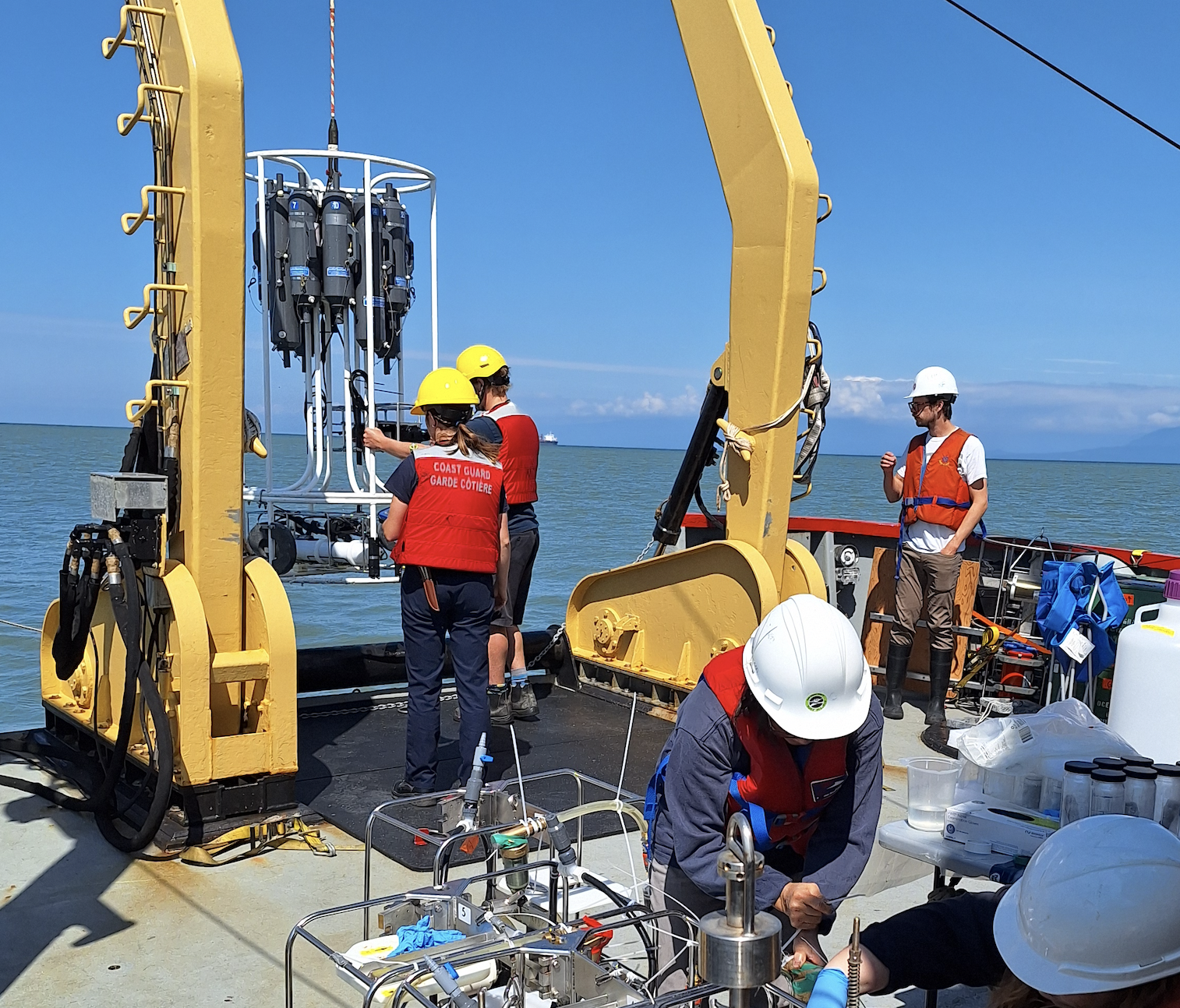
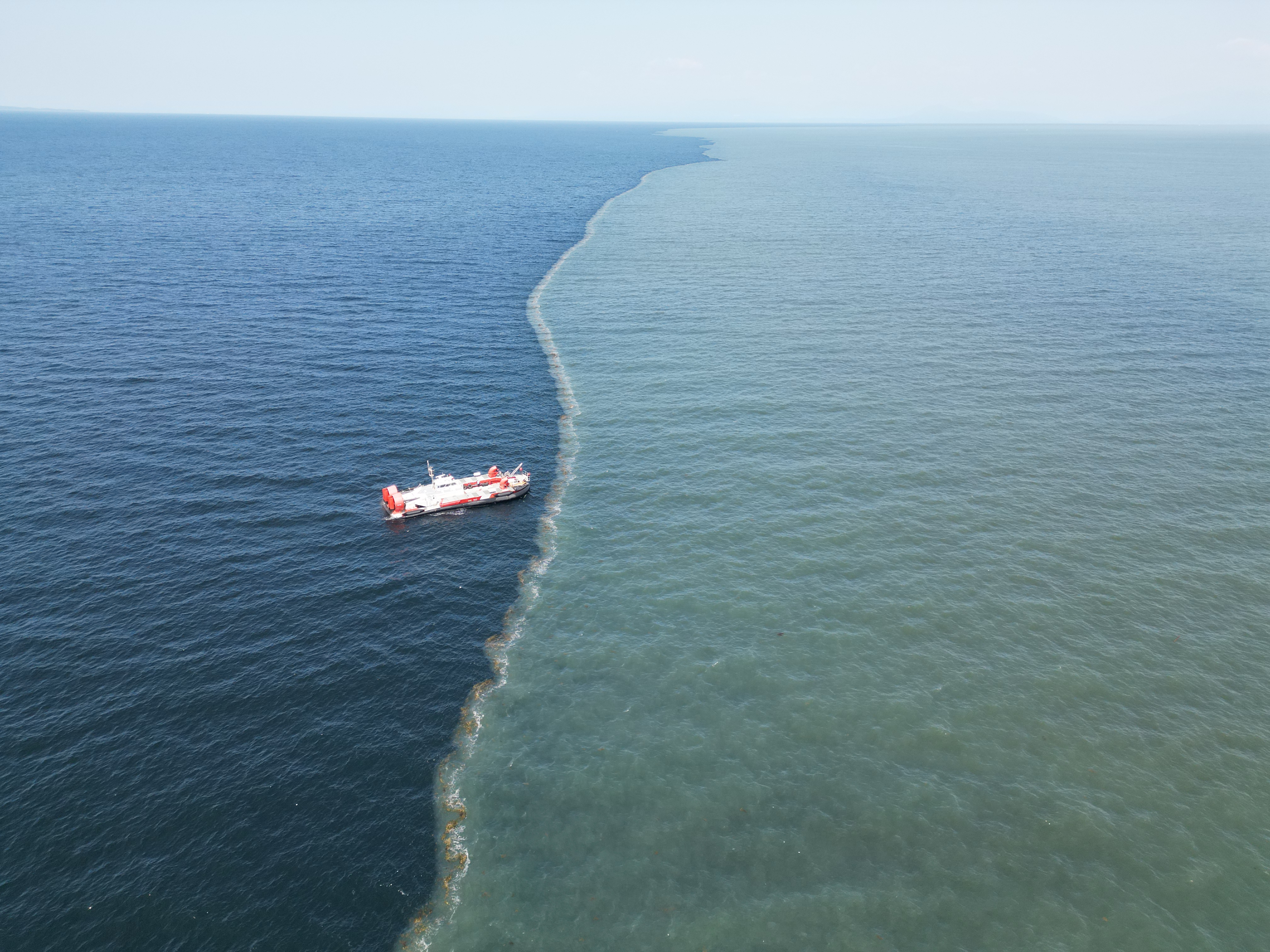
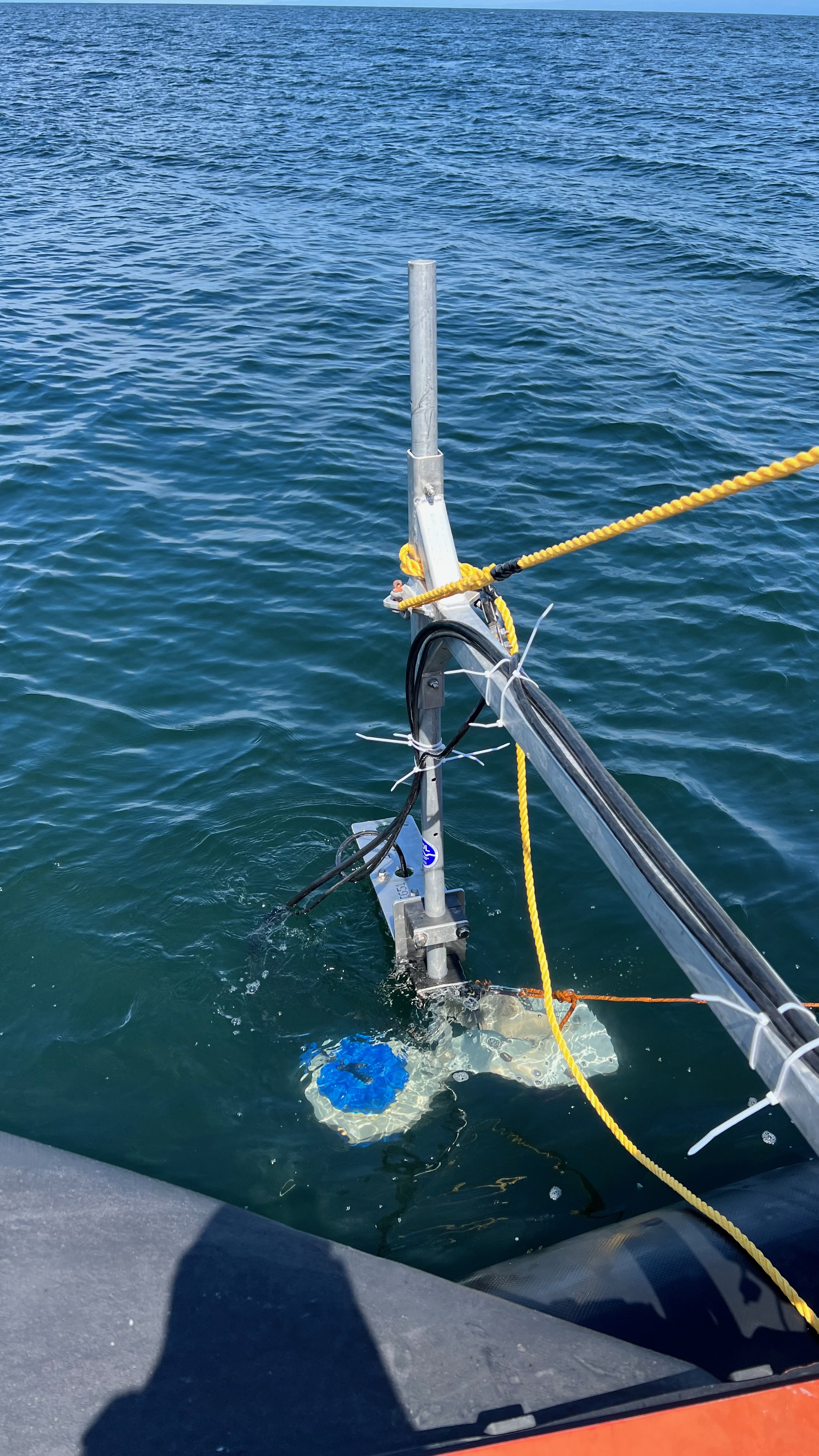
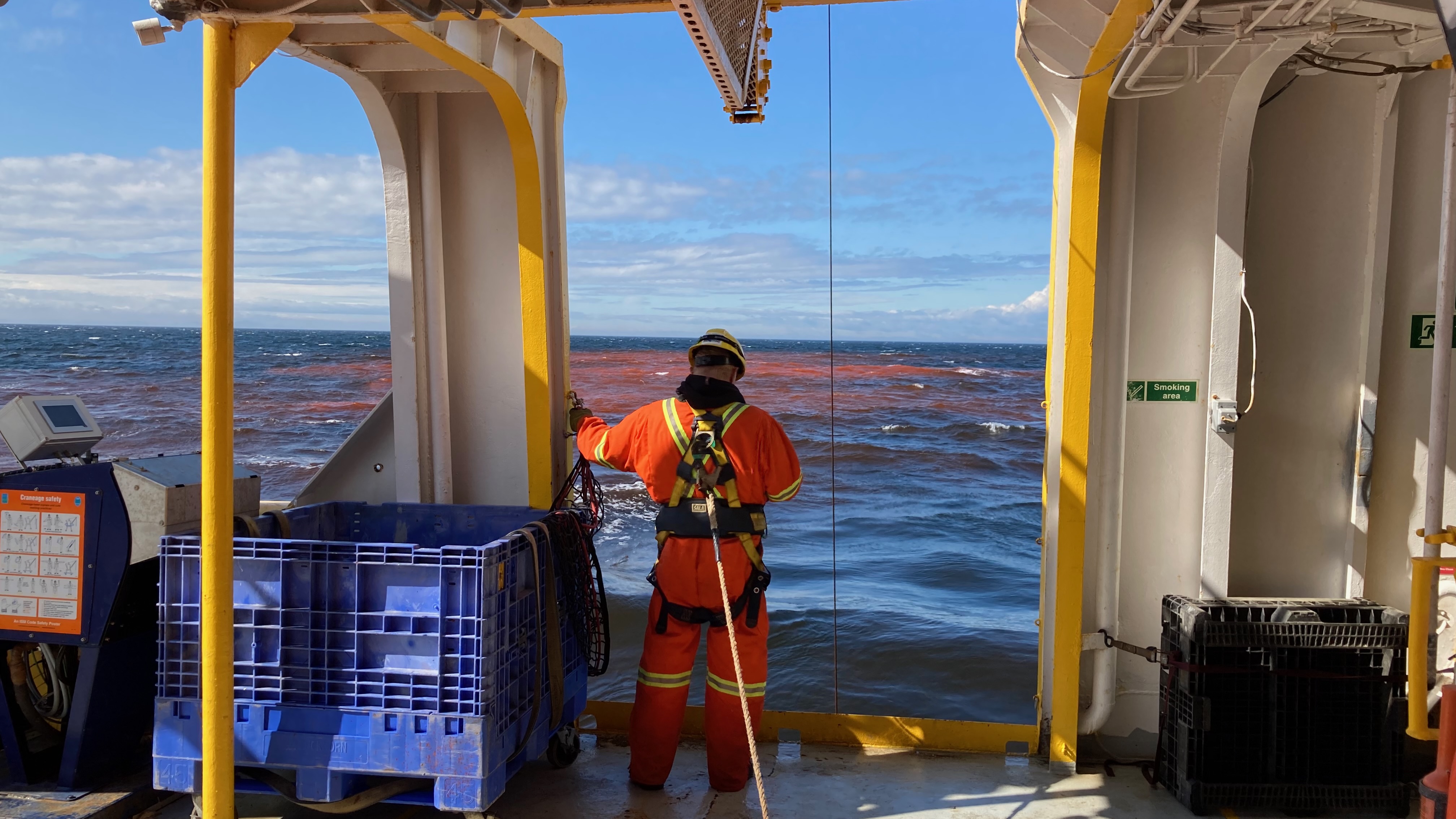
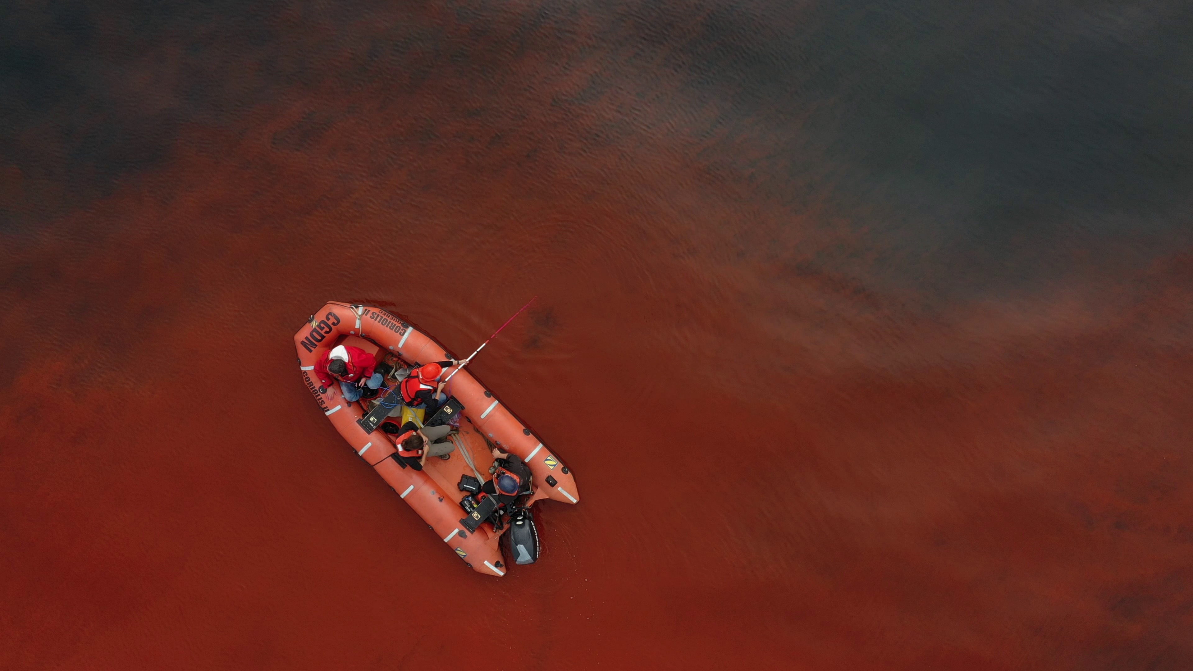
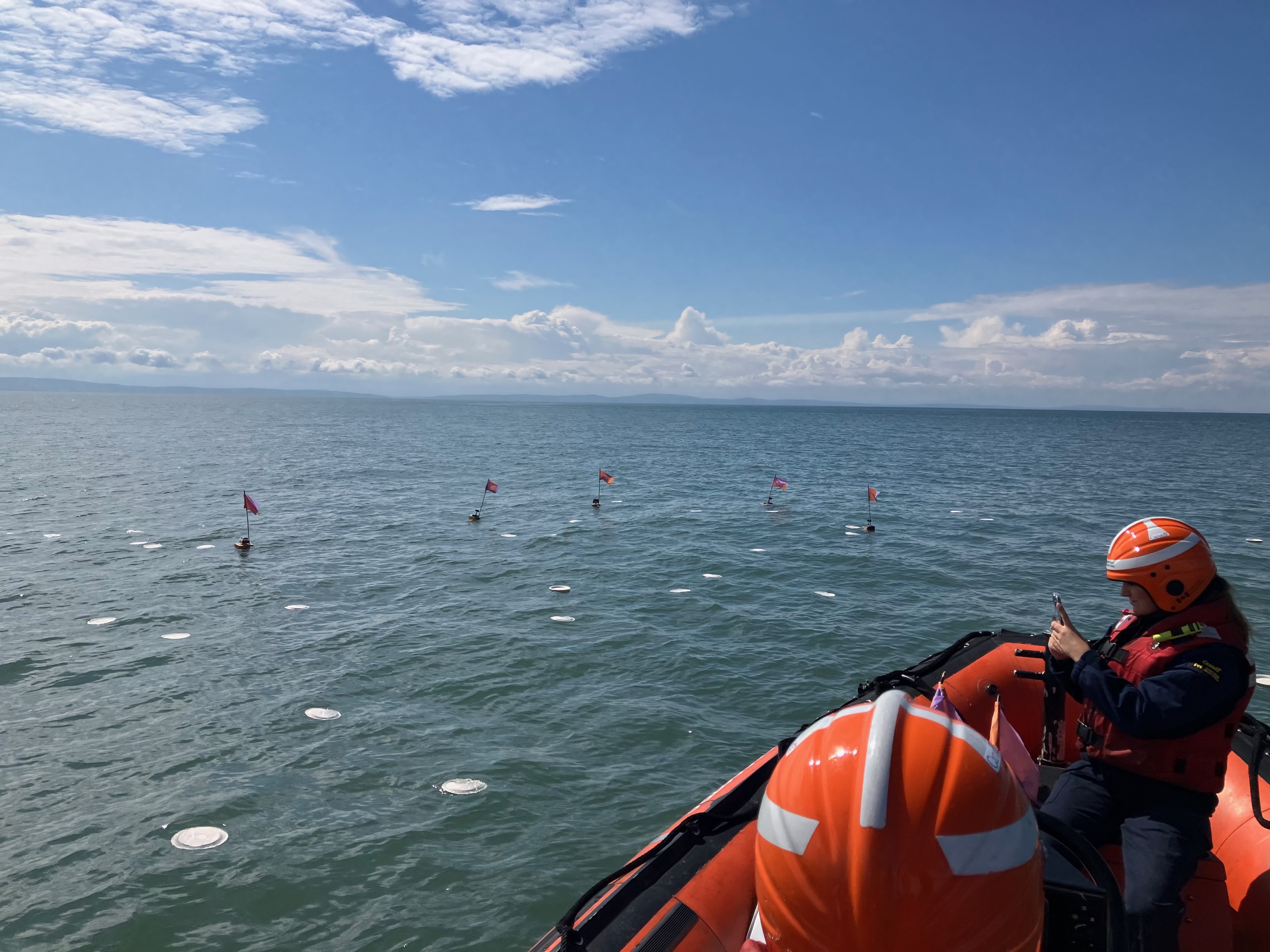
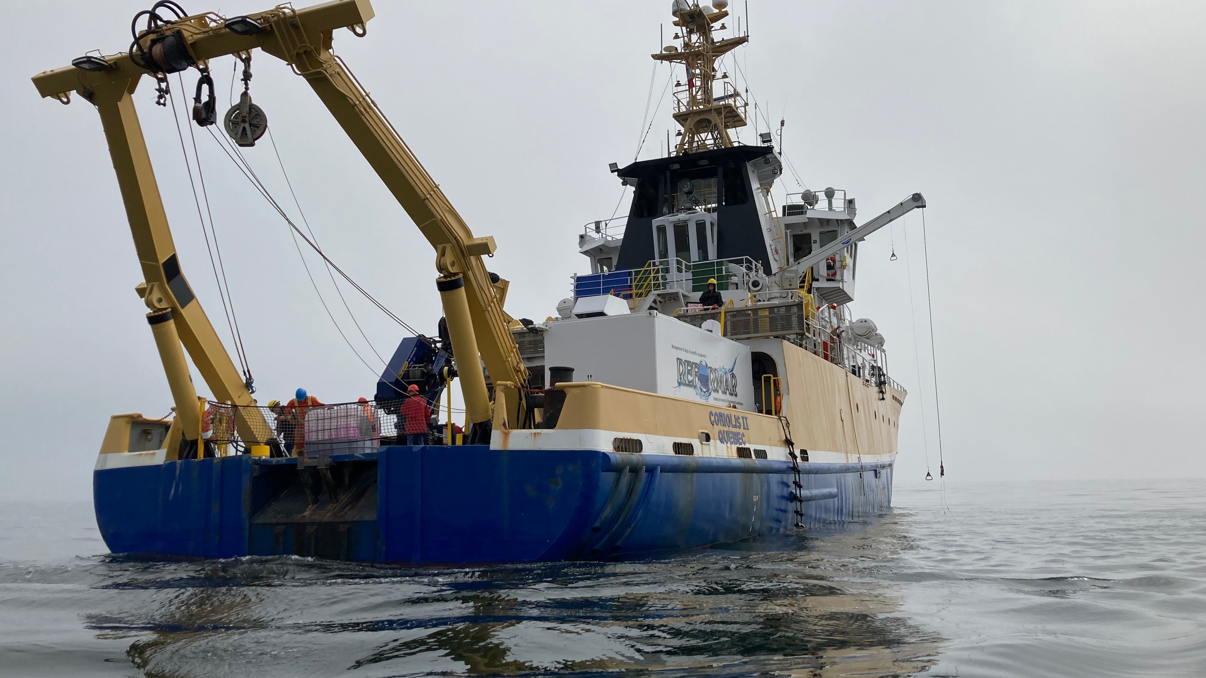
Gallery
Gallery