UBC ATSC 413 - Forest-fire Weather & Climate

Case: Williams Flats, WA

(A heavily researched fire that led to many journal publications. Had an unusual nighttime fire activity.)


Overview

Brief Chronology:
  • Ignited by lightning on 2 Aug 2019.
  • 8,200 (= 3,318 ha) acres burned by 3 Aug.
  • 13,497 (=5,462 ha) acres by 4 Aug.
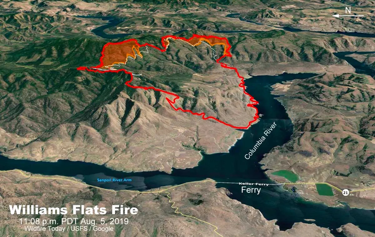
  • 16,781 (=6,791 ha) acres by 6 Aug.
  • "Red Flag" warning issued on 8 Aug, which means hot, dry, windy weather increased the fire-danger risk.
  • 34,000 acres (=13,760 ha) by 8 Aug.
  • 44,446 acres (=17,987 ha) burned in total.
  • 100% contained (under control) by 25 Aug 2019.
Fire Facts:
  • Located in eastern Washington state at the "Colville Indian Reservation"
  • 17,987 ha (= 44,446 acres) burned.
  • Weather: High pressure / anticyclone.
  • Wind issues during daytime, with active burning at night too.
  • Pyrocumulus observed.
  • Heavily studied, including flights by research aircraft as part of FIREX-AQ field program.
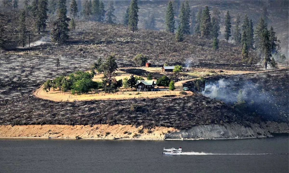
  • "Level 3 (evacuate now)" orders by the Colville Tribes Emergency Services.
  • Responding were: 22 hand crews, 8 helicopters, 18 fire engines, 9 dozers, 22 water tenders, 764 total personnel

News Stories, including Photos and Movies

FIREX-AQ Wildfire Smoke Research during the Williams Flats fire

Maps and Data on Weather and Fire Conditions that You Can Access for this Event

  1. Geography: Overview map https://www.researchgate.net/figure/Geographical-map-of-the-domain-of-study-and-the-Williams-Flats-wildfire-location_fig1_370843598) ,
    topography image, Google map.
  2. Antecedent conditions: Global Wildfire Info System: GWIS (turn on the Fire Danger Forecast, and select the date) .
  3. Surface weather map from the NOAA Weather Prediction Center (WPC): Surface weather map (use the Calendar button to select the date, and then zoom to your region of interest). Also see an explanation of map symbols from the NOAA Jetstream tutorial site.
  4. Polar-orbiting satellite views of thermal anomalies (i.e., wildfire hot spots) via NASA's Worldview of satellite-observed hot spots, (select the date at bottom left, turn on place labels and boarders/coastlines, select Terra and Aqua/ MODIS orbital tracks, and turn on Fires and Thermal Anomalies.
  5. To see Synoptic Weather Maps for this case, use the Forecast Tools link at the top of this web page. Click on the xxx fire button, and use links in the left frame to select the weather maps you want to view. Use the arrow keys on your computer to step forward and backward in time.
  6. xxx
  7. xxx


Credits: both photos: Wildfire Today, search on Williams Flats