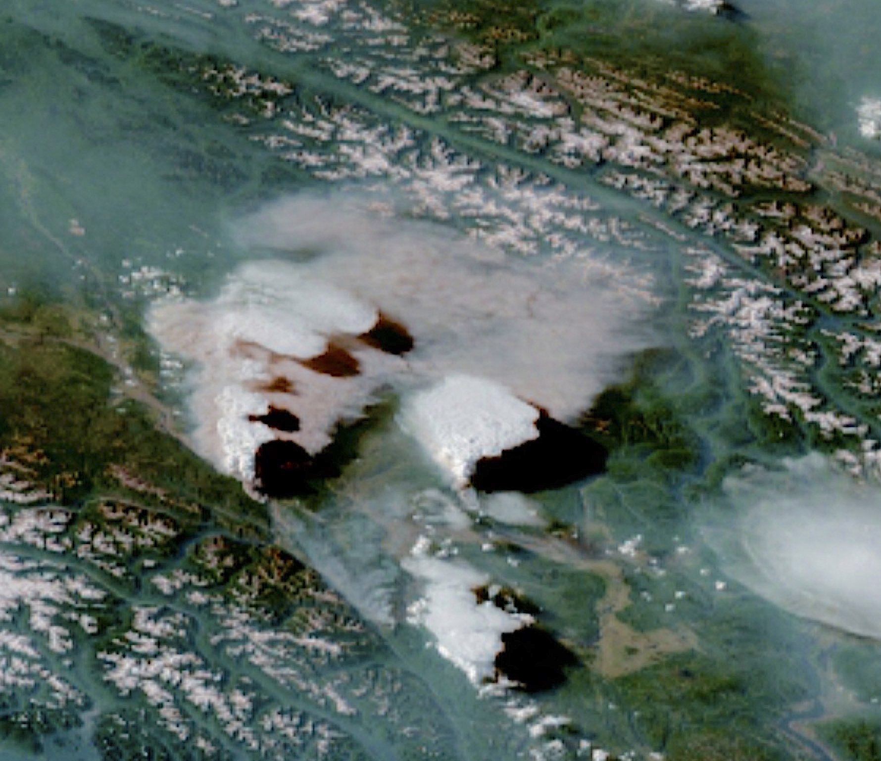
UBC ATSC 413 - Forest-fire Weather & Climate

Case: Sparks Lake, BC

A forensic weather analysis for a fire with multiple pyrocumulonimbus clouds (i.e., forest fires that spawn thunderstorms).

Under construction.


Overview

Brief Chronology:
  • 15 km North of Kamloops Lake, BC.
  • Preceded by historic heat dome. ECCC listed the temperature in Kamloops at 46°C (115°F) at 5 p.m., on afternoon of 29 June.
  • Human caused
  • Discovered 28 June 2021
  • Weather: Spawned multiple pyro-thunderstorms with 710,177 lightning events across British Columbia and northwestern Alberta in about 15 hours, between 3 p.m. on June 30 and 6 a.m. on July 1, as measured by the North American Lightning Detection Network. This lightning spawned many more wildfires.
  • Being held as of 26 Aug 2021
  • Under control on 5 Sep 2021
  • Worldview satellite images: https://go.nasa.gov/3YYlLTU
  • Earth Observatory summary with photos: Blazes Rage in British Columbia
  • GOES satellite loop of pyro-thunderstorms.
Fire Facts:
  • Fire ID: K21001.
  • Official Name: "Sparks Lake"
  • One of 3 fires in the "Sparks Lake Complex":
    Sparks Lake (K21001), Embleton Mountain (K21644), & Tremont Creek (K21849)
  • Total burned area: 95,980 ha
  • Damaged or destroyed 52 buildings
  • 69 days out of control
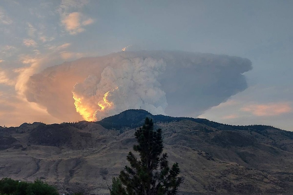
  • The potential source of the blaze was traced to a burnt out vehicle at what appeared to be an old marijuana grow operation. The vehicle had no plates, and the Vehicle Identification Number too badly burnt to read. The make and model wasn't even visible anymore, but officers at the scene believed it most likely to be an older GMC Jimmy or Chevrolet Blazer based on its shape.
  • By mid July: 90 firefighters, 10 helicopters, 58 pieces of heavy equipment,109 support personnel, including 32 members of the Skeetchestn Indian Band helping with structural protection.
  • 6 Evacuation Orders were issued.

News Stories, including Photos and Movies

Timeline of Fire and Weather Evolution

Maps and Data on Weather and Fire Conditions that You Can Access for this Event

  1. Geography ( BC Forest Height Map , or BC topographic map: coarse , fine , and Google map zoomed to Sparks Lake )
  2. Antecedent conditions: Global Wildfire Info System: GWIS (turn on the Fire Danger Forecast, and select the date) .
  3. Surface weather map from the NOAA Weather Prediction Center (WPC): Surface weather map (use the Calendar button to select the date, and then zoom to your region of interest). Also see an explanation of map symbols from the NOAA Jetstream tutorial site.
  4. Worldview satellite images: https://go.nasa.gov/3YYlLTU
  5. To see Synoptic Weather Maps for this case, use the Forecast Tools link at the top of this web page. Click on the Sparks Lake fire button, and use links in the left frame to select the weather maps you want to view. Use the arrow keys on your computer to step forward and backward in time.

Credits:  
• Top: https://rammb-slider.cira.colostate.edu/
• Bottom: Melissa Martin. https://www.castlegarnews.com/news/wildfire-north-of-kamloops-grows-to-20000-hectares-136-properties-evacuated/