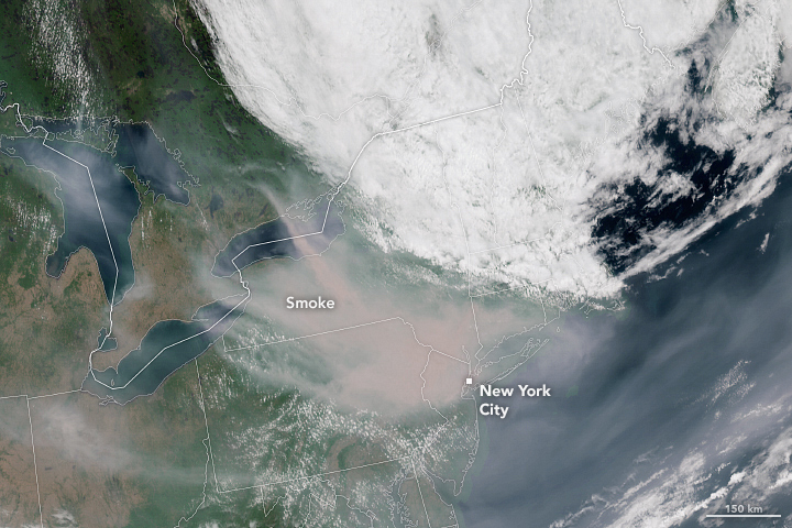
UBC ATSC 413 - Forest-fire Weather & Climate

Case: Quebec Complex, QC

(Still not fully under control by the start of Fall term 2023.)

Under construction.


Overview

Brief Chronology:
  • Timing: Major outburst beginning on and around 1 June 2023.
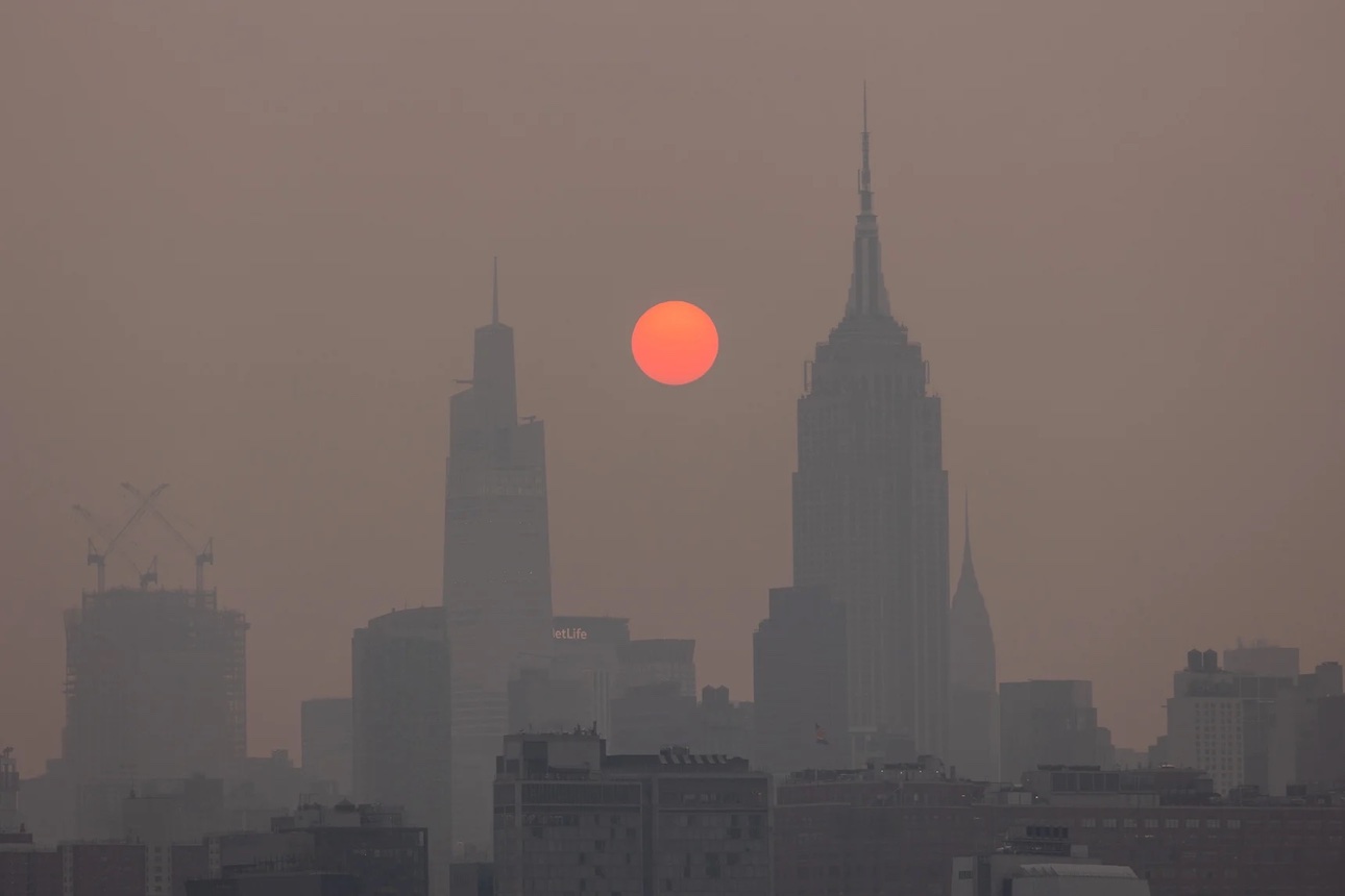
  • Location: Spread across south and central Québec .
  • First nations affected: Cree, Atikamekw, Innus, Algonquins, and more. Visit https://www.sac- isc.gc.ca/eng/1634312499368/1634312554965 to see a map of indigenous communities in Québec.
  • Suspected cause: Mix of lightning and human causes
  • Many fires in the complex continued "out of control" as of 27 June 2023. By 21 Aug 2023 some were under control, and others out of control.
  • Antededent conditions: long period of hot, dry weather
  • Weather factors: omega block, mid-latitude cyclone, and cold front with lightning-generating thunderstorms.
  • On xxx, xxx Wildfire declared the fire to be under control.
  • On xxx, the fire was finally extinguished.
Fire Facts:
  • Name: QB Fire 334
    (but there were hundreds of other fires in the area)
  • 1 June 2023 – Unknown
  • Burned area as of June 2023: ~1,000,000 ha
  • xxx days out of control
  • Required xxx
  • xxx personnel fighting this fire
  • Evacuation Orders were issued for xxx, displacing over xxx residents from their homes.

News Stories, including Photos and Movies

Presentation Goals and Tips

Reading Assignment

Useful Links

Timeline of Fire and Weather Evolution

Maps and Data on Weather and Fire Conditions that You Can Access for this Event

  1. Geography (Google Maps )
  2. Antecedent conditions: Global Wildfire Info System: GWIS (turn on the Fire Danger Forecast, and select the date) .
  3. Surface weather map from the NOAA Weather Prediction Center (WPC): Surface weather map (use the Calendar button to select the date, and then zoom to your region of interest). Also see an explanation of map symbols from the NOAA Jetstream tutorial site.
  4. NASA's Worldview satellite images: https://go.nasa.gov/3L3wUgu .
  5. To see Synoptic Weather Maps for this case, use the Forecast Tools link at the top of this web page. Click on the Quebec Fires button, and use links in the left frame to select the weather maps you want to view. Use the arrow keys on your computer to step forward and backward in time.


Image Credits:
top: Yuki Iwamura / via NBC News via Bloomberg via Getty Images
bottom: NASA Earth Observatory: https://earthobservatory.nasa.gov/images/151433/smoke-smothers-the-northeast