UBC ATSC 413 - Forest-fire Weather & Climate

Case: Donnie Creek Complex, BC

Drought, spring dip, and fast shifting winds associated with a mid-latitude cyclone caused the largest fire in BC history in 2023, including holdover fires into 2024.


Overview

Brief Chronology:
  • The fire starting on 12 May 2023 at 4:58 pm due to lightning.
  • Drought and "Spring Dip" were factors in its ignition and initial growth.
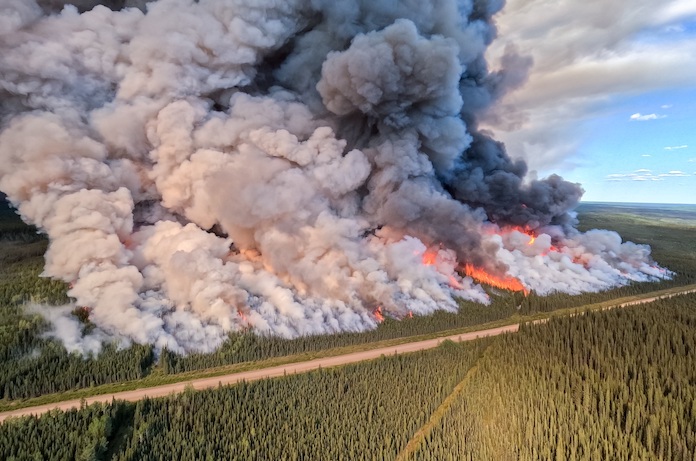
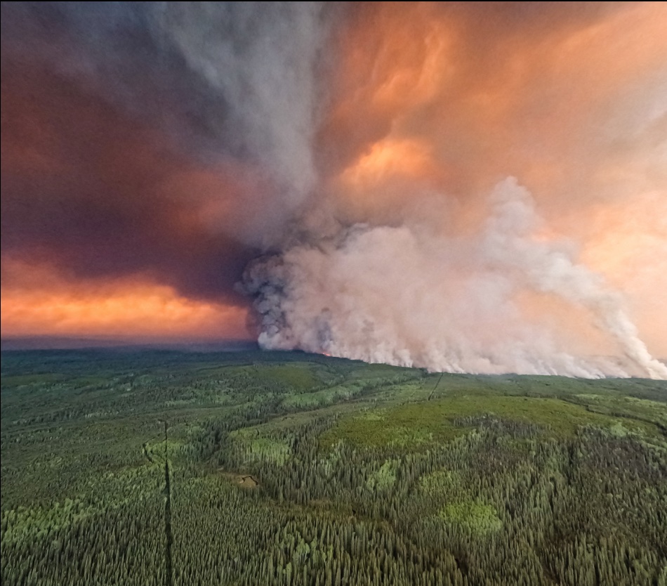
  • "It exhibited aggressive fire growth, taking a 30 kilometre run just five days after receiving 40 millimetres of rain", reported BCWS.
  • 487,509 ha burned as of 14 Jun 2023. Still out of control at that time.
  • Continued out of control thru 9 Aug 2023.
  • Not fully extinguished when winter freeze and snows happened.
  • Re-emerged in Spring 2024 as a holdover fire (in control).
  • Total multi-year size: 619,072.5 ha as of July 2024
Fire Facts:
  • Fire Number: G80280
  • Official Name: "Donnie Creek Complex"
  • approximately 136 km southeast of Fort Nelson and 158 km north of Fort St. John, BC.
  • firefighters: 188 personnel, 11 helicopters, 1 incident management team, 28 pieces of heavy equipment as of mid 2023.
  • Weather: In addition to Spring Dip and dwought, later affected by a mid-latitude cyclone.
  • Worldview satellite image: https://go.nasa.gov/45stIDk
  • Evacuation Orders were issued for xxx, displacing over xxx residents from their homes.

News Stories, including Photos and Movies

Timeline of Fire and Weather Evolution

Maps and Data on Weather and Fire Conditions that You Can Access for this Event

  1. Geography: Donnie Creek fire map (BCWS, Jul 2023) , and map of all BC 2024 fires (including the Donnie Creek holdover fire map).
  2. Antecedent conditions: Global Wildfire Info System: GWIS (turn on the Fire Danger Forecast, and select the date) .
  3. Surface weather map from the NOAA Weather Prediction Center (WPC): Surface weather map (use the Calendar button to select the date, and then zoom to your region of interest). Also see an explanation of map symbols from the NOAA Jetstream tutorial site.
  4. Polar-orbiting satellite views of thermal anomalies (i.e., wildfire hot spots) via NASA's Worldview of satellite-observed hot spots, (select the date at bottom left, turn on place labels and boarders/coastlines, select Terra and Aqua/ MODIS orbital tracks, and turn on Fires and Thermal Anomalies.
  5. To see Synoptic Weather Maps for this case, use the Forecast Tools link at the top of this web page. Click on the Donnie Creek fire button, and use links in the left frame to select the weather maps you want to view. Use the arrow keys on your computer to step forward and backward in time.
  6. xxx