(A combination of terrain and synoptic pressure differences created extreme downslope winds.)
Under construction.
Overview
Brief Chronology:
The fire starting on 8 Nov 2018 due to an electric power line.
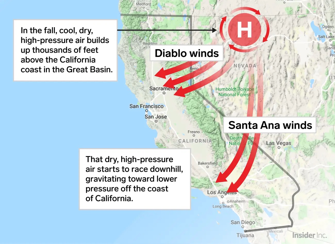
Very strong downslope winds from the East descended down the Sierra Nevada mountains towards lower elevations of the California central valley, and toward lower pressure off the California coast.
On 25 Nov 2018, the fire was finally extinguished.
Fire Facts:
Fire ID: xxx
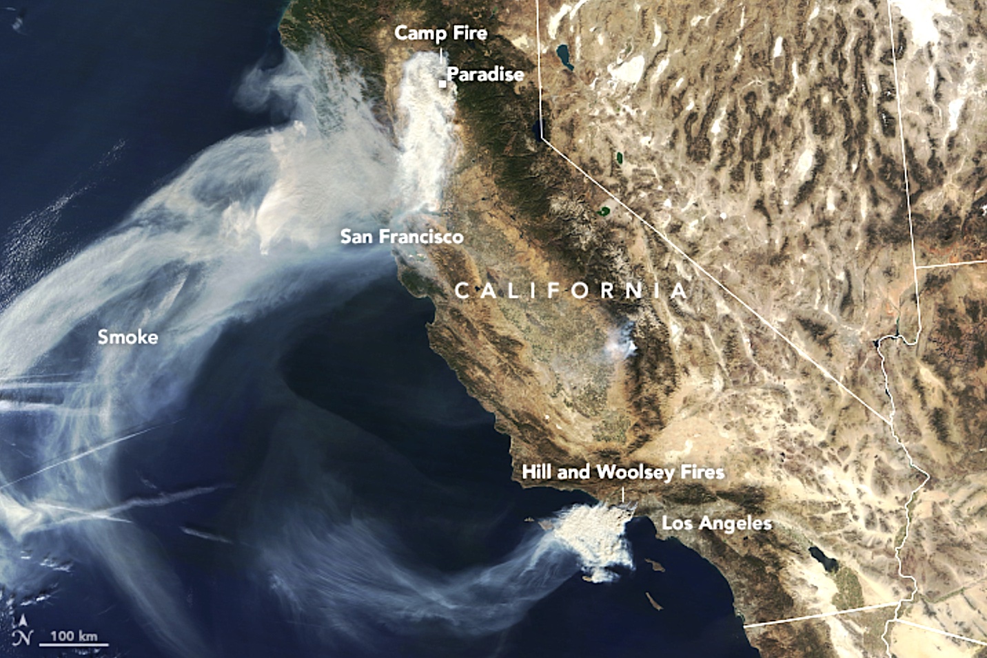
Official Name: Camp Fire (sometimes referred to as the Paradise Fire).
Location: Paradise, California
8-25 November 2018
Burned area: 62,053 hectares (153,336 acres)
Ignition Source: Electrical transmission fire from a PG&E power line
McClung, B. and C. F. Mass, 2020: The strong, dry winds of Central and Northern California: Climatology and synoptic evolution. Weather and Forecasting, 35, 2163 - 2178. DOI: 10.1175/WAF-D-19-0221.1 .
Reading Assignment
section 17.10 on Downslope Winds, in Stull, R. 2018: Practical Meteorology: An Algebra Based Survey of Atmospheric Science. -version 1.02b. Univ. of British Columbia. 940 pages. isbn 978-0-88865-283-6 .
Maps and Data on Weather and Fire Conditions that You Can Access for this Event
Geography (Google Maps)
Antecedent conditions: Global Wildfire Info System: GWIS (turn on the Fire Danger Forecast, and select the date) .
Surface weather map from the NOAA Weather Prediction Center (WPC): Surface weather map (use the Calendar button to select the date, and then zoom to your region of interest). Also see an explanation of map symbols from the NOAA Jetstream tutorial site.
To see Synoptic Weather Maps for this case, use the Forecast Tools link at the top of this web page. Click on the Camp Fire button, and use links in the left frame to select the weather maps you want to view. Use the arrow keys on your computer to step forward and backward in time.
Credits:
• Top: NASA Worldview
• Bottom: Business Insider https://i.insider.com/5c10313877a1651f482b6acb?width=1300&format=jpeg&auto=webp