Image/Video
Caption and Source
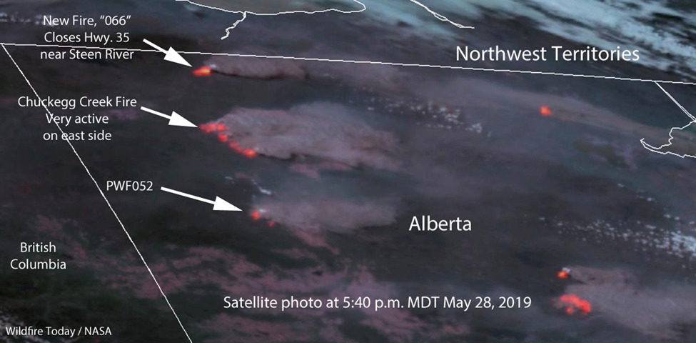
Satellite photo showing the location of wildfires in Northern Alberta May 28, 2019.
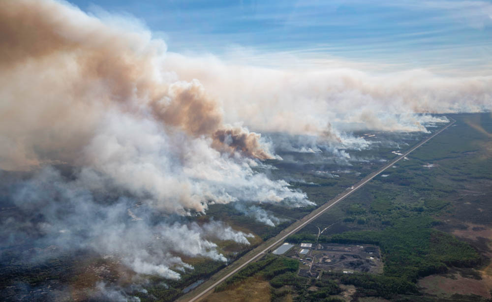
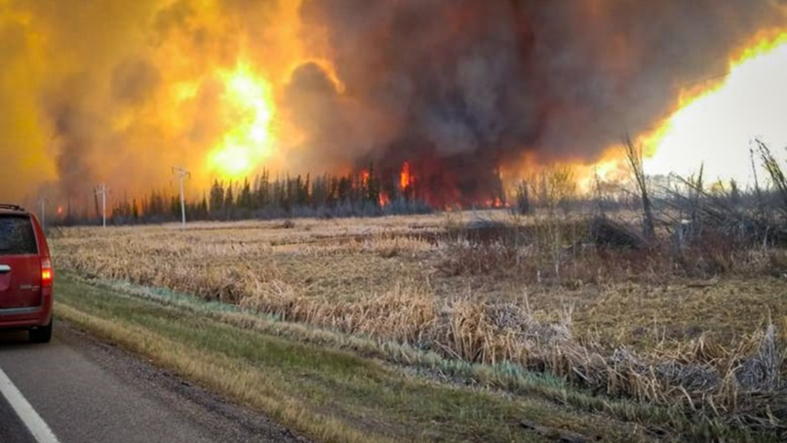
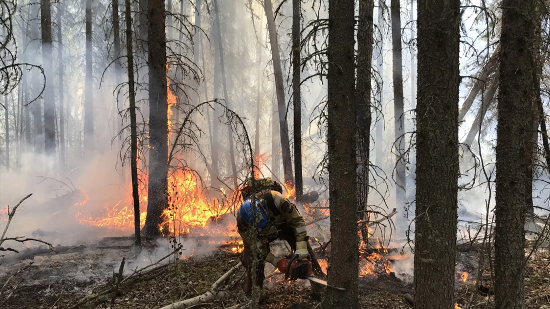
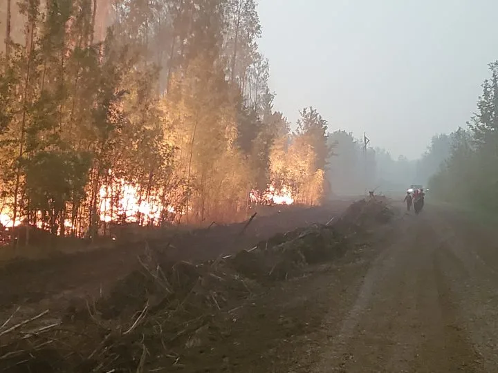
The Chuckegg Creek Fire, looking west along highway 58, west of High Level, Alberta on Saturday evening, May 25, 2019. (photograph by Chris Schwarz/Government of Alberta).
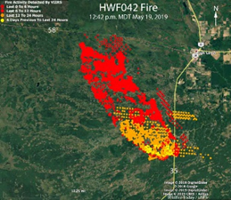
Map of the wildfire southwest of High Level, Alberta at 12:14 p.m. CDT May 19, 2019. |
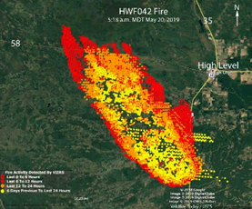
Map of the Chuckegg Creek HWF042 wildfire southwest of High Level, Alberta at 5:18 a.m. CDT May 20, 2019. |
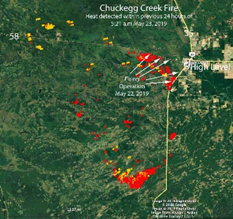
Map by Wildfire Today showing heat that was detected in the 24 hours previous to 5:21 a.m. MDT May 23, 2019. The arrows indicate where firefighters conducted a burnout or firing operation along Highways 58 and 35 to help protect the town of High Level, Alberta. |
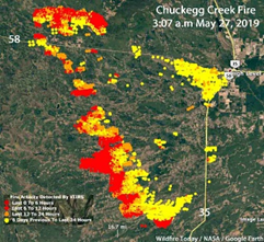
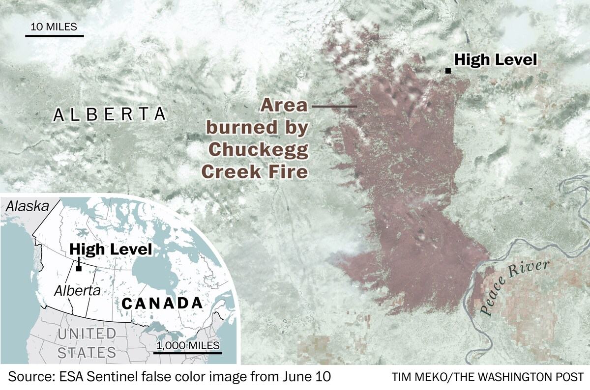
Map showing heat detected by a satellite on the Chuckegg Creek Fire near High Level, Alberta during the seven days prior to May 27, 2019. |
Series of satellite images from https://wildfiretoday.com/tag/chuckegg-creek-fire/:
July 2, 60% contained
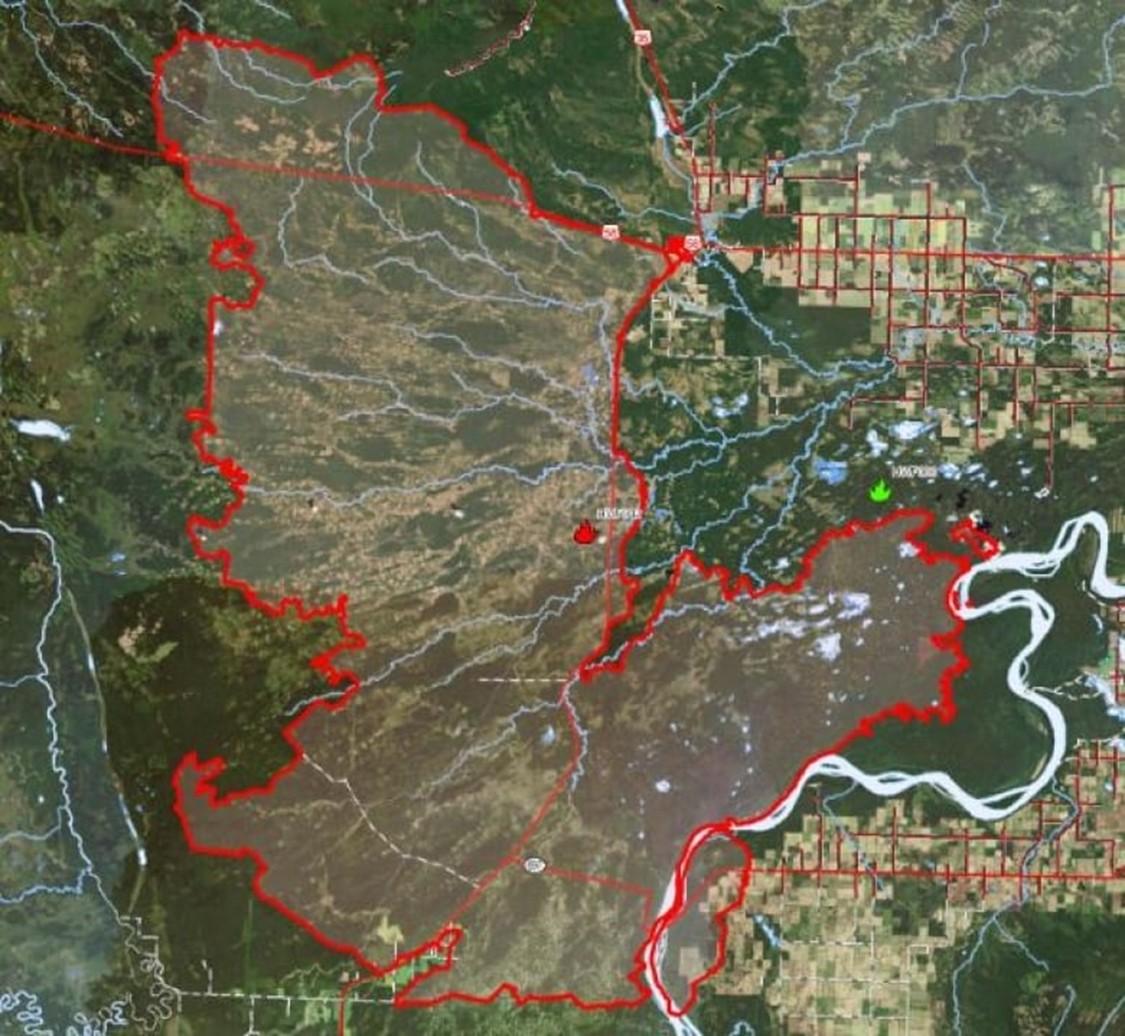
This map shows the perimeter of the Chuckegg Creek wildfire burning in northern Alberta. (Alberta Wildfire)
https://www.cbc.ca/news/canada/edmonton/chuckegg-creek-wildfire-alberta-contained-1.5197356

Chuckegg Creek Wildfire. Photo: Town of High Level
https://www.cjwe.ca/news/news/chuckegg-creek-wildfire-update/
https://www.cjwe.ca/news/news/northern-alberta-wildfire-update-may-23-1200-pm/
An estimated 800 firefighters and support staff continue to fight the Chuckegg wildfire, a 350,000-hectare blaze in northern Alberta. (Courtesy: Alberta Wildfire)
https://edmonton.ctvnews.ca/chuckegg-wildfire-being-held-for-first-time-since-may-1.4524111
On Friday, Aug. 23, 2019, Alberta Wildfire announced the Chuckegg Creek wildfire was finally under control. Courtesy, Alberta Wildfire
https://globalnews.ca/news/5806201/alberta-wildfire-chuckegg-creek-under-control/
The Chuckegg Creek wildfire in the High Level area has officially been extinguished (Photo: Alberta Wildfire)
https://everythinggp.com/2020/10/22/chuckegg-creek-wildfire-extinguished-17-months-after-igniting/
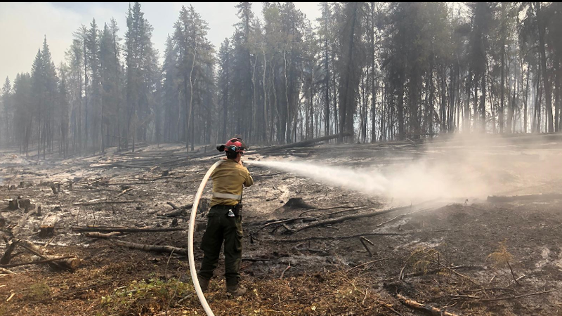
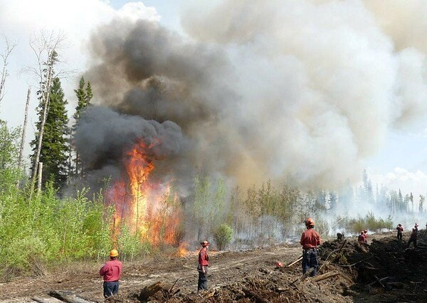
Firefighters work on the south end of the Chuckegg Creek fire near Paddle Prairie on June 1, 2019. Courtesy: Alberta Wildfire
https://globalnews.ca/news/5344125/high-level-evacuation-order-lifted-alberta-wildfires/
Firefighters monitor the Chuckegg Creek fire southwest of High Level earlier this week. Four from Black Diamond and Turner Valley spent a week assisting with the blaze, returning home yesterday.
https://www.okotokstoday.ca/local-news/firefighters-home-from-high-level-1537547
Aerial footage
https://www.cbc.ca/player/play/1721091651838
(good short clip of flames close up)
Footage from ground
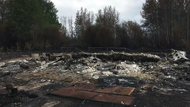
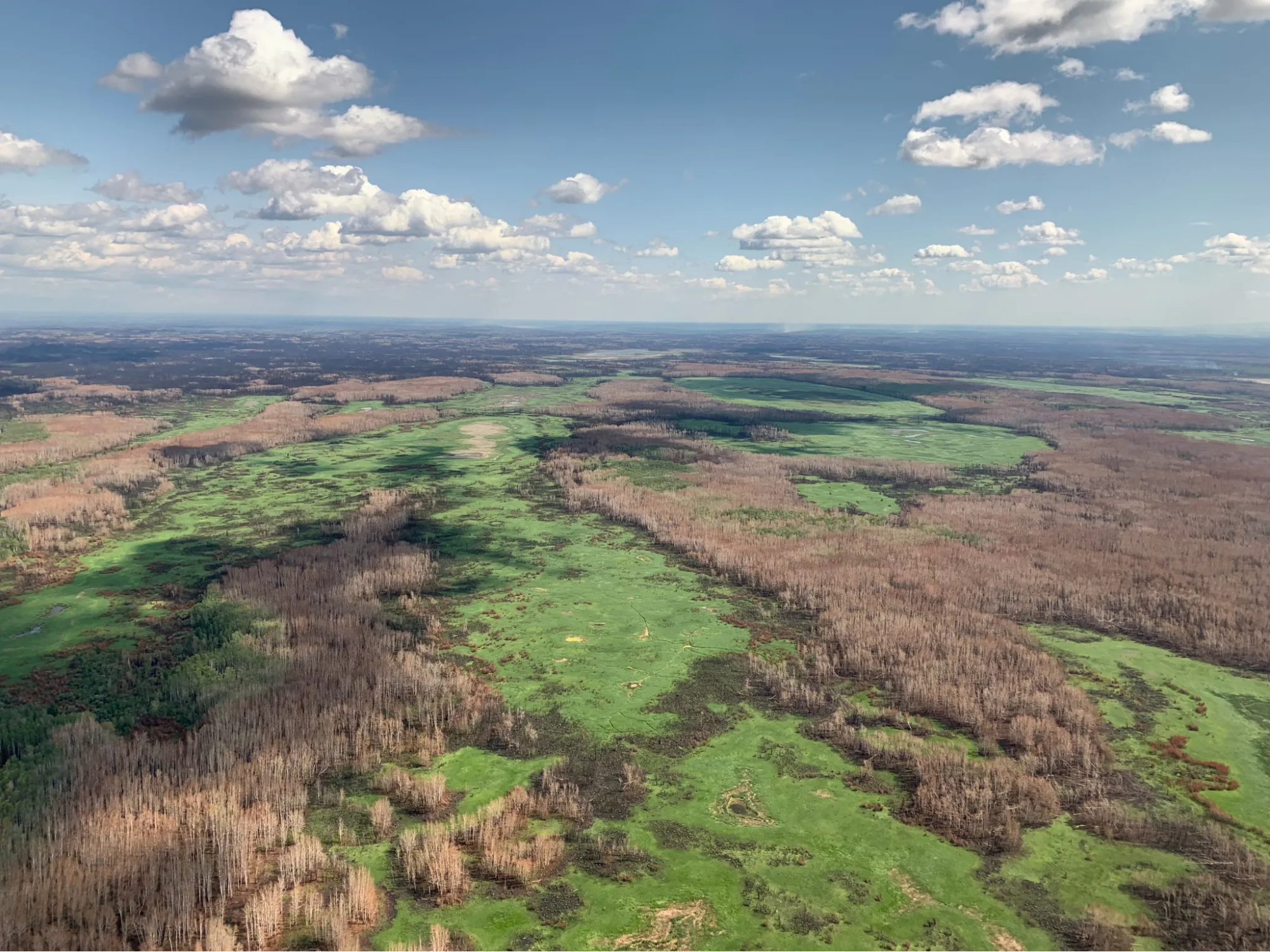
Destruction of homes and property in Paddle Prairie Métis Settlement (near High Level)
(also has photos):
The Chuckegg Creek fire, which covers about 270,000 hectares, remains out of control. Photo: Tamara Pimentel/APTN)
News video of destruction in Paddle Prairie
- (https://srd.web.alberta.ca/high-level-area-update/high-level-forest-area-wildfire-update-0-0-0-0-0-0-0-0-0)
- https://www.cbc.ca/news/canada/edmonton/slave-lake-wildfire-evacuation-high-level-1.5143124)
Links to other news stories about the fire.