Image/Video
Caption and Source

Donnie creek fire burned area (biggest fire on map) as of may 19th.
Source:
https://wildfiresituation.nrs.gov.bc.ca/incidents?fireYear=2023&incidentNumber=G80280
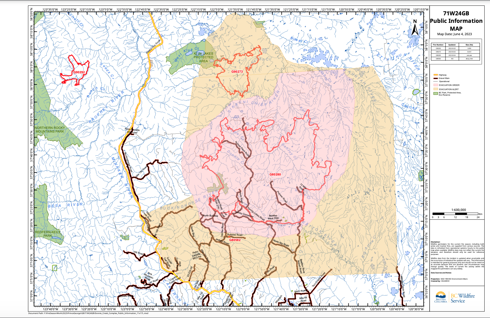
Donnie Creek wildfire burned area (biggest fire on map) as of june 4th
source:
https://wildfiresituation.nrs.gov.bc.ca/incidents?fireYear=2023&incidentNumber=G80280
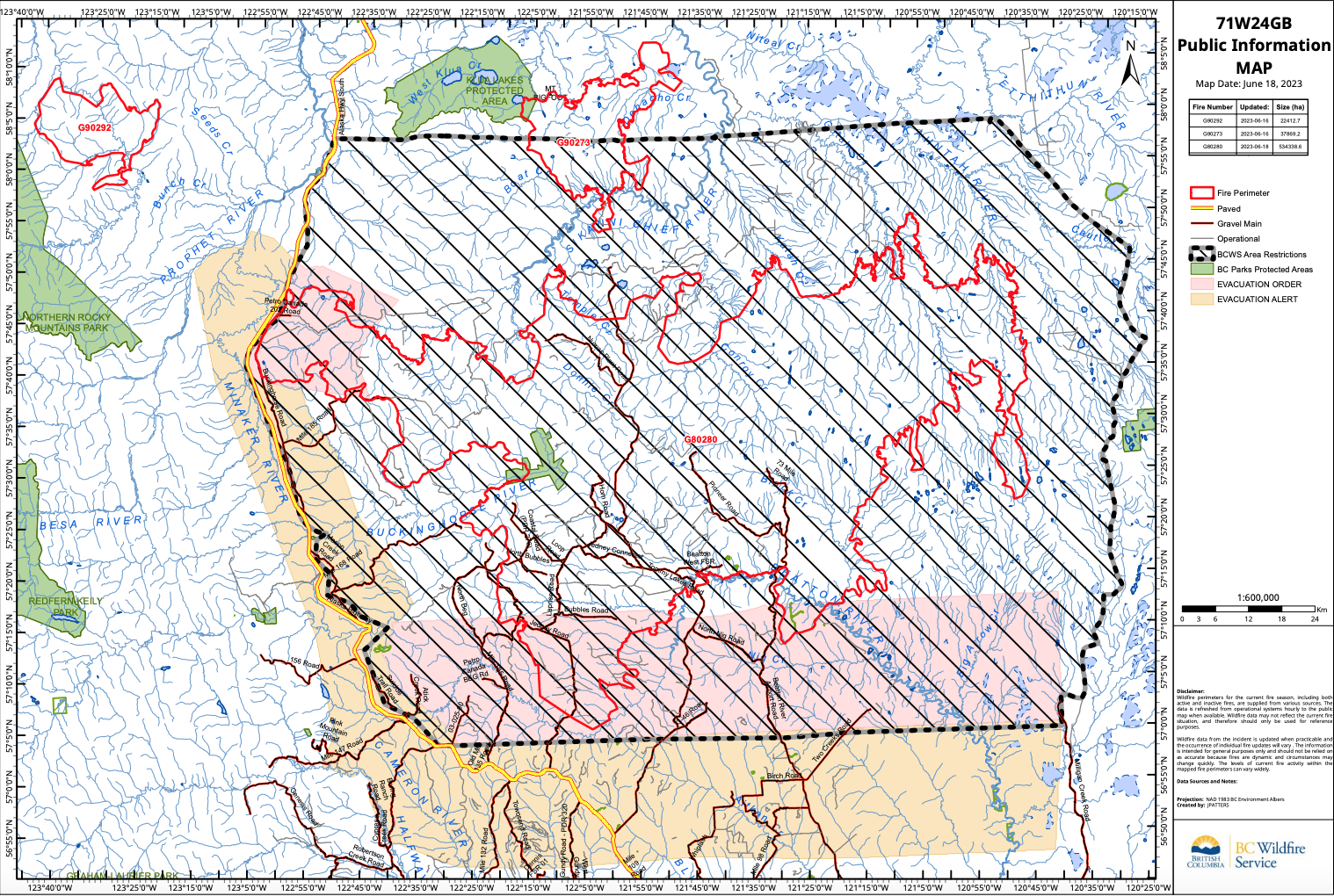
Donnie Creek wildfire burned area (biggest fire on map) as of june 18th
Note that the area surrounding the fire is now totally restricted.

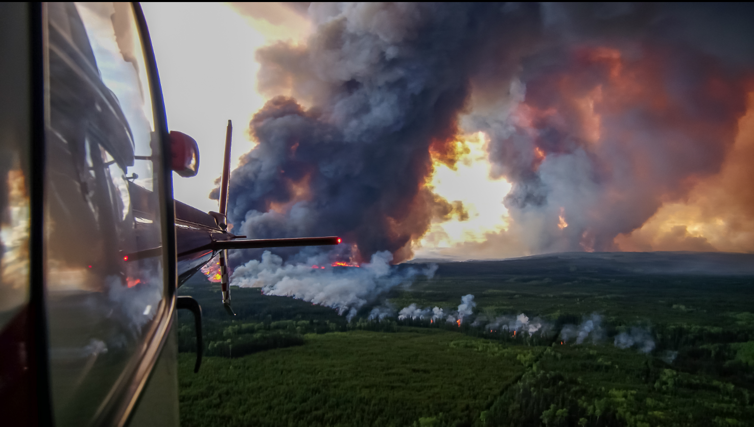

No original captions; all description generated by Jalena Bennett. Images provided by BC Wildfire service
Source for next 13 photos:
https://wildfiresituation.nrs.gov.bc.ca/incidents?fireYear=2023&incidentNumber=G80280
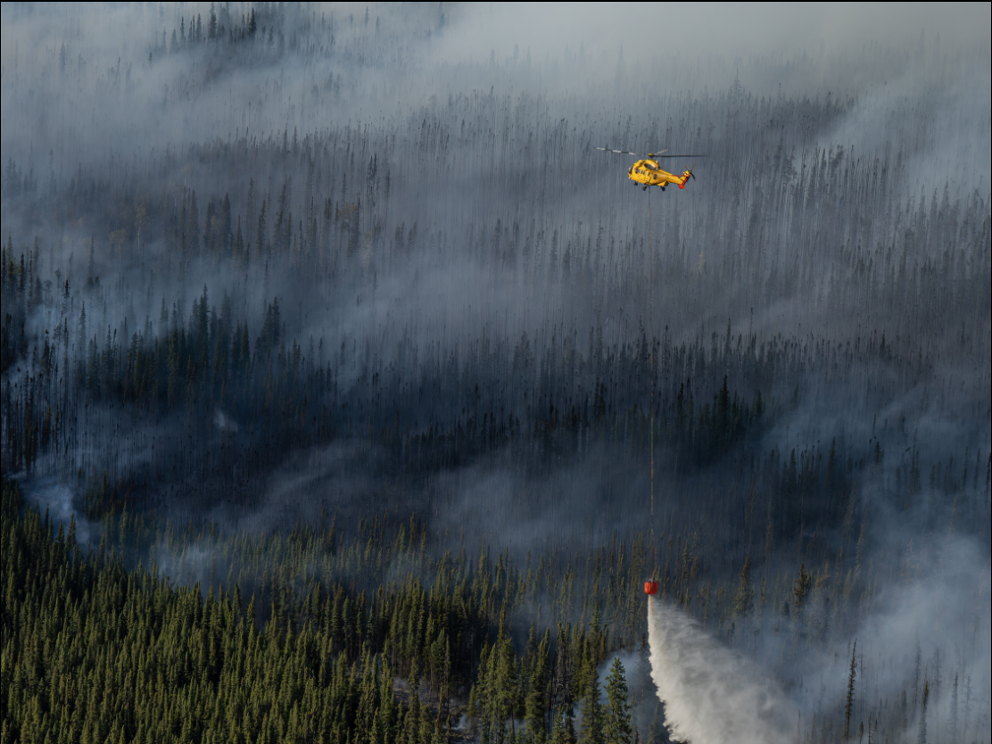
(Helicopter dousing still smoldering forest with water)
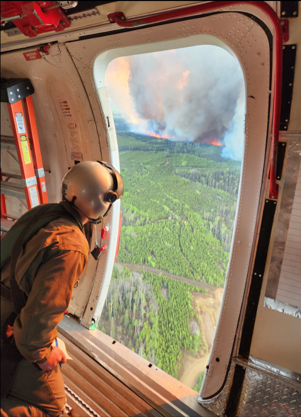
(fire suppression personnel looking at blaze from the sky)
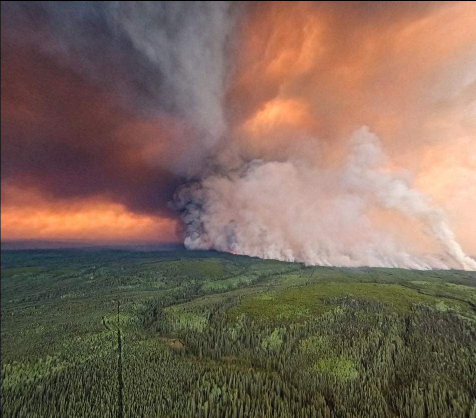
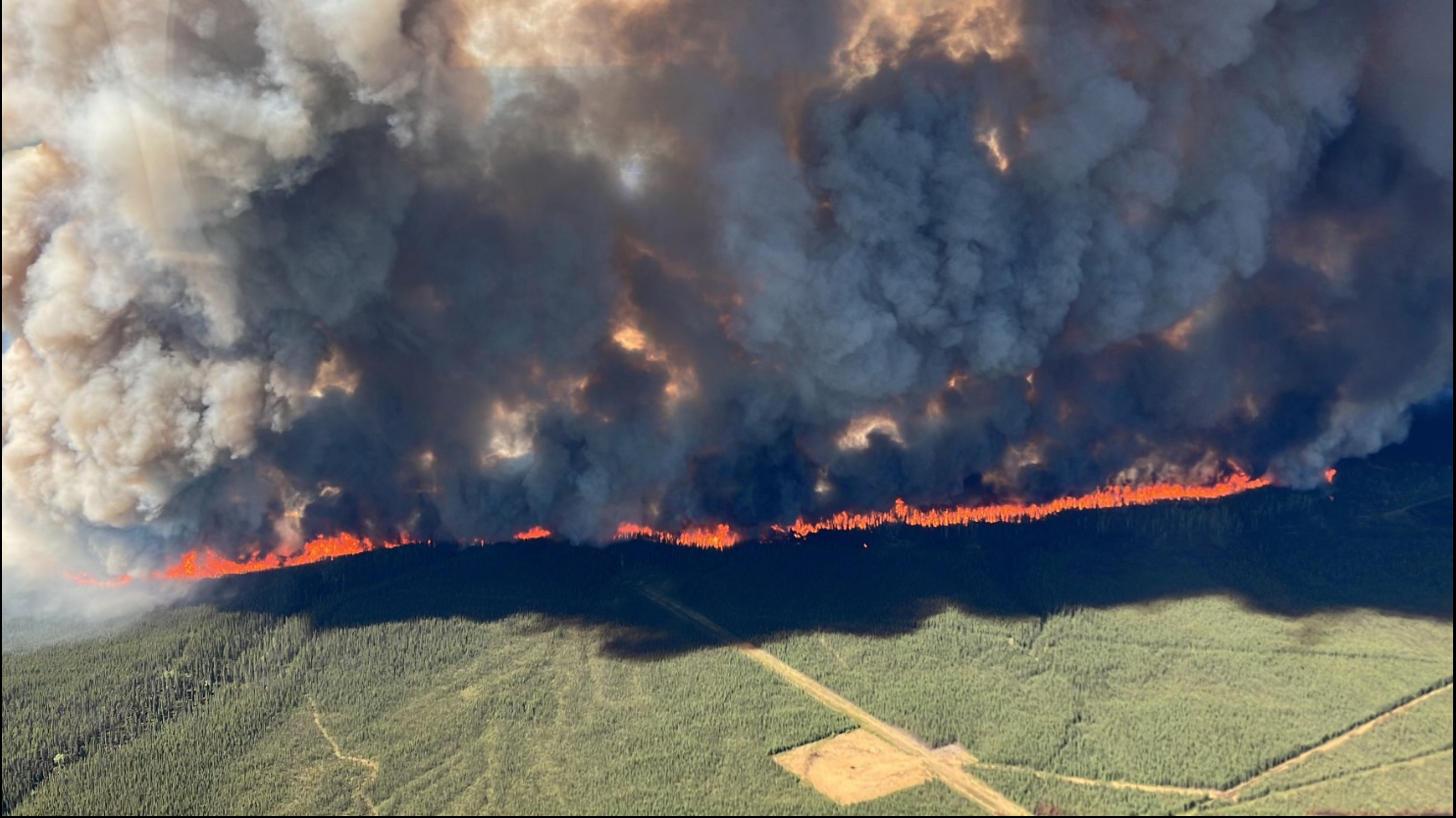
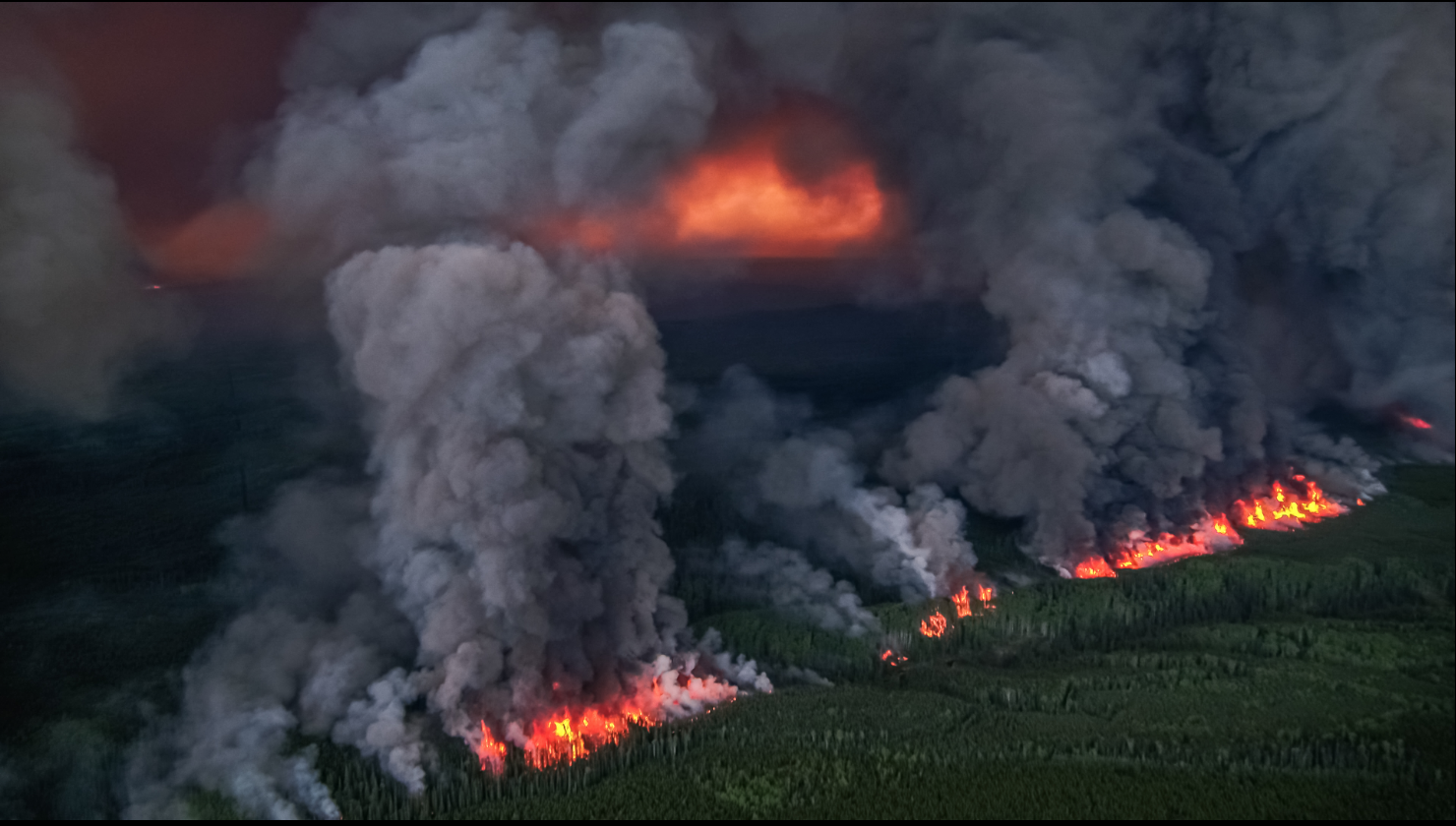
(fire raging through a forested region)
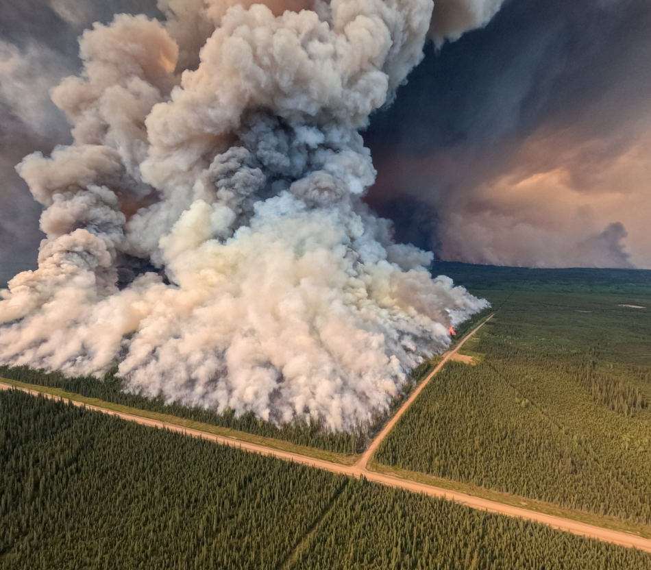
(Massive burn scar left behind by the blaze. Active fire continues to burn under smoke plume)
(fire burns in a near-straight line, emitting massive amounts of smoke)
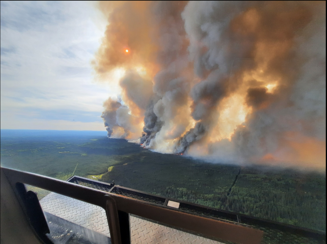
(Fire suppression personnel in a helicopter capture an image of air rising off of a burning area and generating smoke filled cumulus clouds. If convection continues, pyrocumulonimbus clouds may result.)
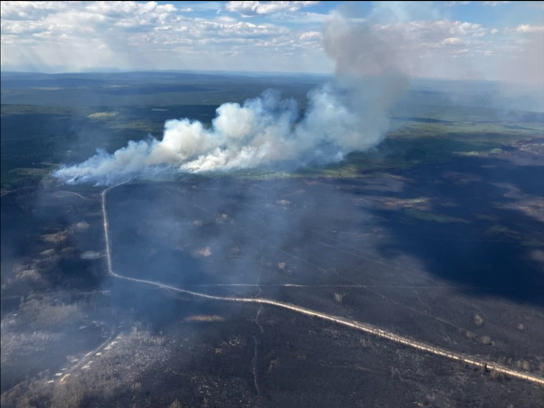
(more smoke along fire lines)
(smoke rising from a square area - result of planned ignitions to contain spread)
(Fire at twilight - dim lighting conditions show how bright the fire burns underneath all the smoke)
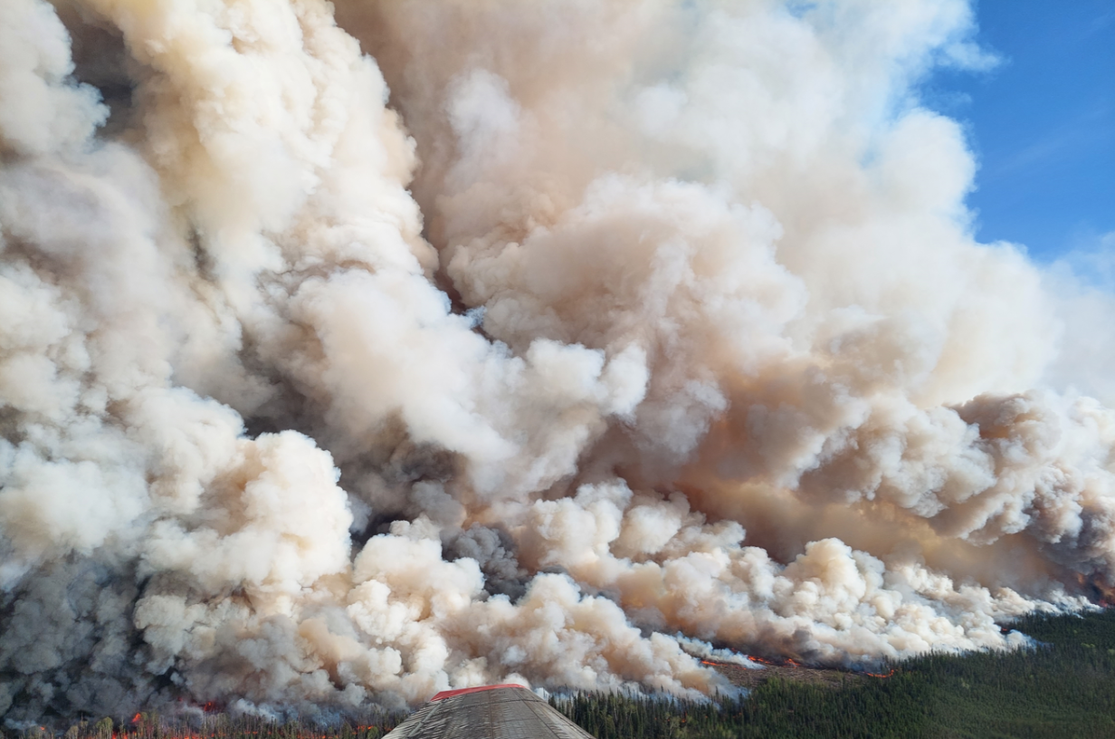
Massive smoke plumes rising into a ‘blue sky’ photographed from fire suppression personnel on an airplane.
Smoke rising from active burning darkens the sky, building large orange smoke clouds above the fire.
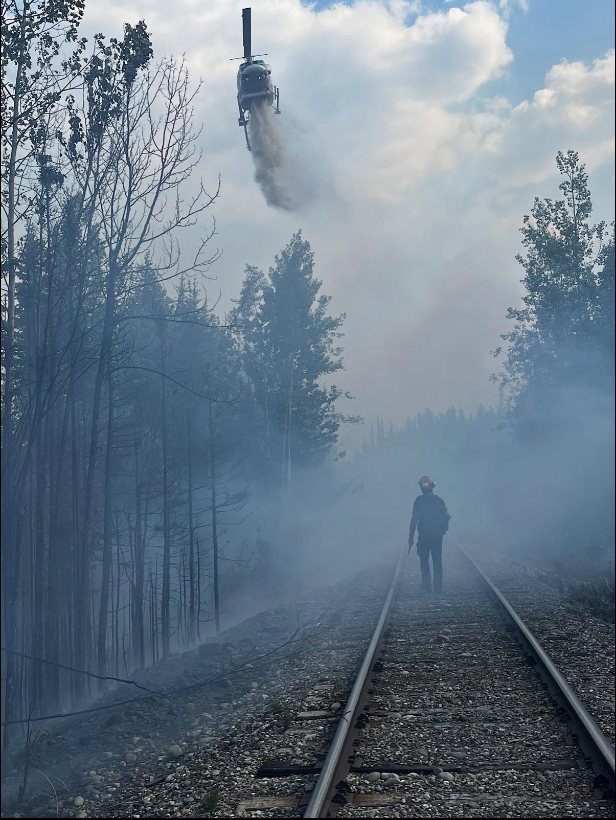
Firefighter observing fire suppression efforts from the ground.

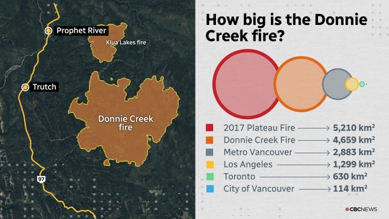
Size of Donnie Creek fire accurate as of June 13. Source: B.C. Wildfire Service (Akshay Kulkarni/CBC)
“Donnie Creek wildfire now nearly double the size of Metro Vancouver as hundreds more properties under threat”
https://globalnews.ca/video/rd/a7a7c0c4-04af-11ee-891e-0242ac110006/?jwsource=cl
Wildfire in B.C.’s northeast the second largest in provincial history
News report of Donnie Creek wildfire from Global News. Video shows aerial footage of fire burning through forested regions, and massive columns of smoke rising into the air.
Further Evacuations Issued as Donnie Creek Wildfire Surpasses 1 Million Acres in British Columbia
https://www.youtube.com/watch?v=pQvzakrqs6o&ab_channel=CTVNews
Donnie Creek fire getting closer to highway
“This footage was filmed by Dan Hardt, who says he recorded it along the Alaska Highway, near the community of Wonowon, shows smoke from the Donnie Creek wildfire on Monday afternoon.”
Video shows smoke plumes off in the distance on a day (june 12th) where the fire was burning just 3 km away from the major highway connecting BC to Alaska.
Only 0:00 - 0:59 is relevant; shows the same footage as above, but also includes experts talking about fire.
https://www.youtube.com/watch?v=tTKSmdrfzqU&ab_channel=BCWildfireService
Donnie Creek Wildfire, Planned Ignitions Update June 2, 2023
https://www.youtube.com/watch?v=FAaV6d2OD6U&t=198s&ab_channel=BCWildfireService
Donnie Creek Wildfire, Planned Ignitions Update June 4, 2023
https://www.youtube.com/watch?v=zc2I6Yv8eNc&t=134s&ab_channel=BCWildfireService
Donnie Creek Wildfire, fuel types and fire behavior, June 5, 2023
https://www.youtube.com/watch?v=8RdXzb0Itcw&t=10s&ab_channel=BCWildfireService
Donnie Creek Complex Update, June 7, 2023
Videos produced by BC Wildfire Service. Include updates to fire as it is burning, explanation planned ignitions, location fuel types, and many many clips of massive smoke plumes while fire torches the forested region.
B.C. wildfires: Donnie Creek evacuation order issued for 14 more properties
News report on fire, including a June 12th, 2023 update on size and evacuations.
Video mentions that as of June 12th, Donnie creek fire is approximately the size of Switzerland!
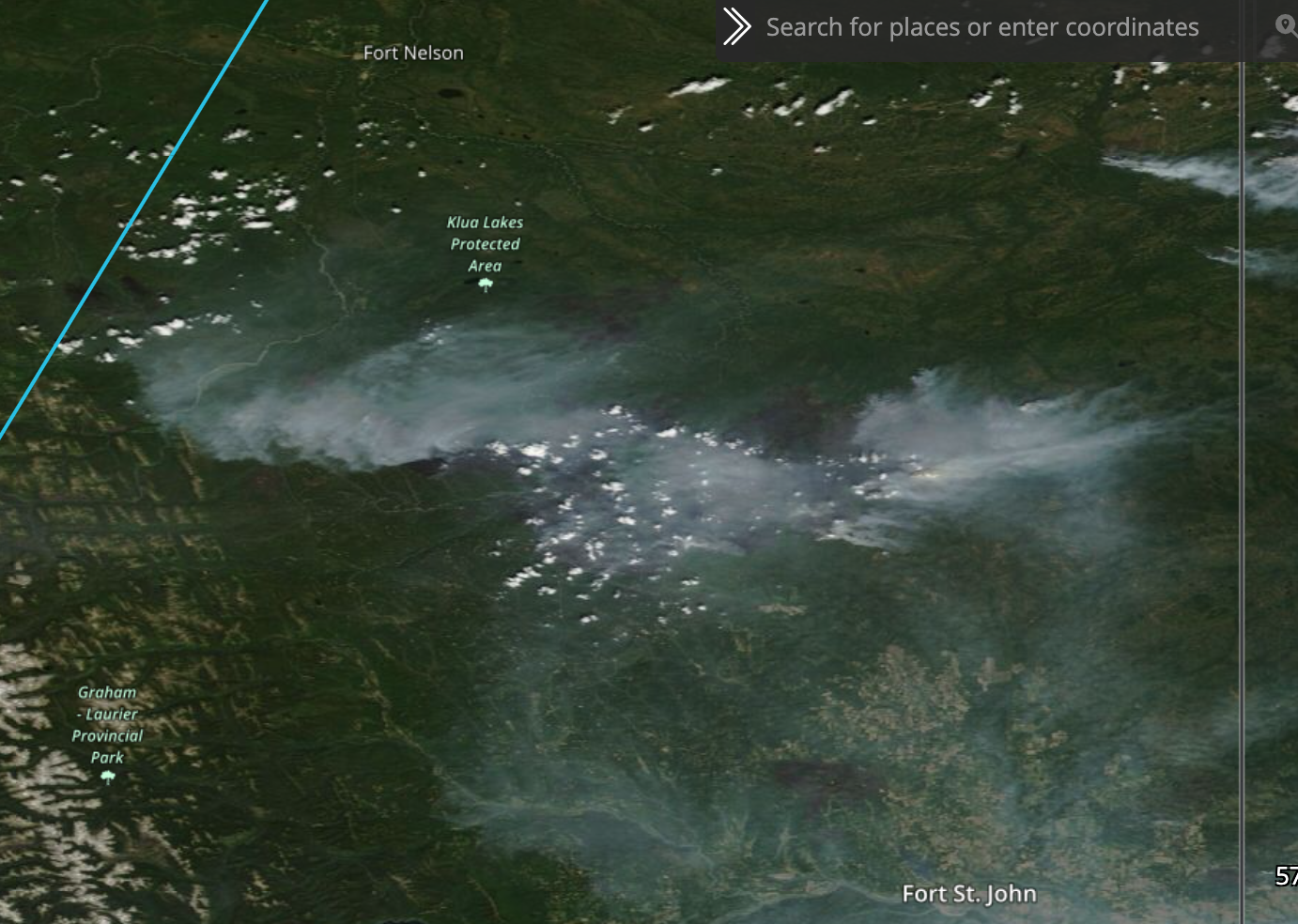
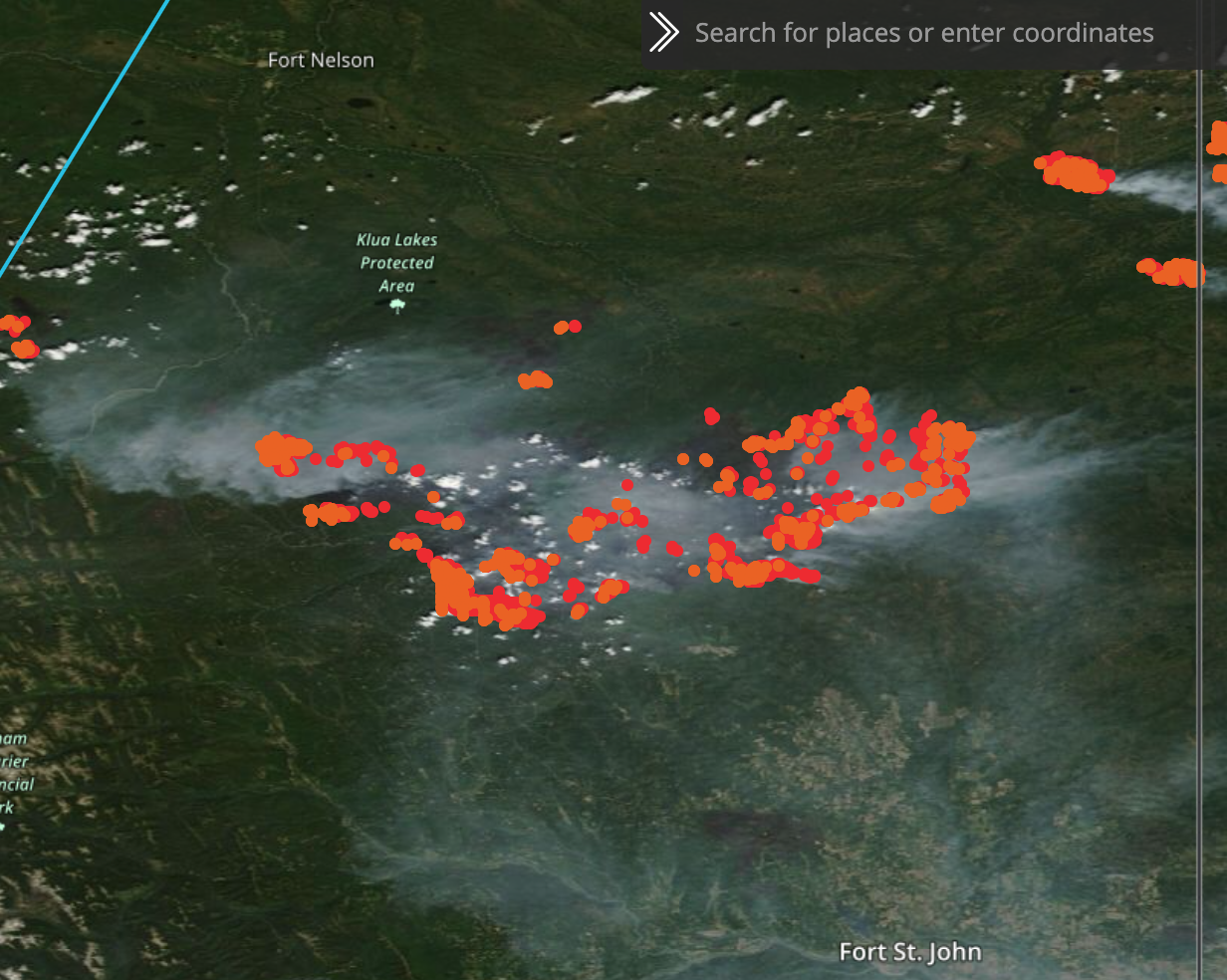
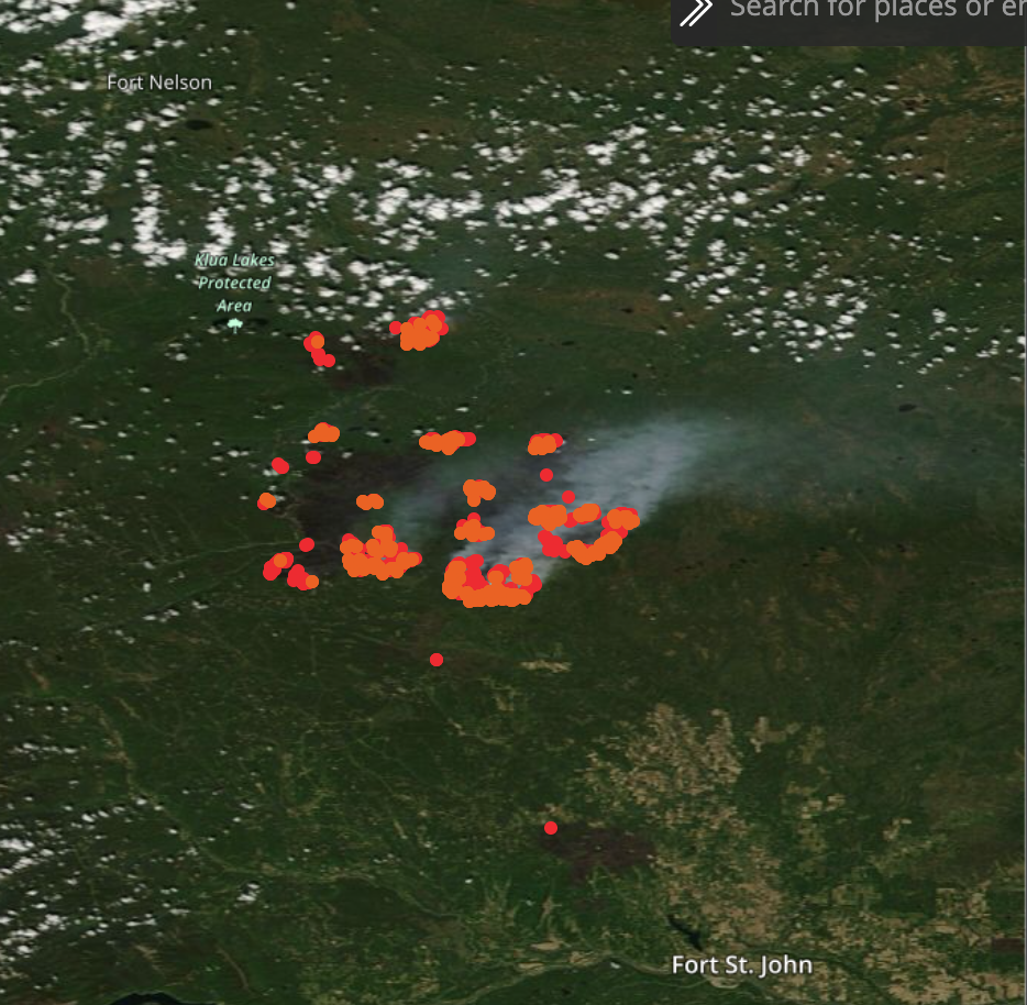
Satellite Image on June 11th, 2023 from Polar Orbiting Satellites show massive burn scars underneath a layer of smoke.
Red/orange dots on the second image are satellite detected fires/thermal anomalies.
Source:
- June 1st, same area captured by satellite imagery. Burn scars are more visible, and burning area is not as large as june 11th. Demonstrates how large the fire grew in just 10 days.