Module f14
Step 5. Data Available at Start of Trip
Weather Map
Here is the surface weather map for 12 UTC (8 am EDT), where the purple "X" shows the approximate location of Toronto.
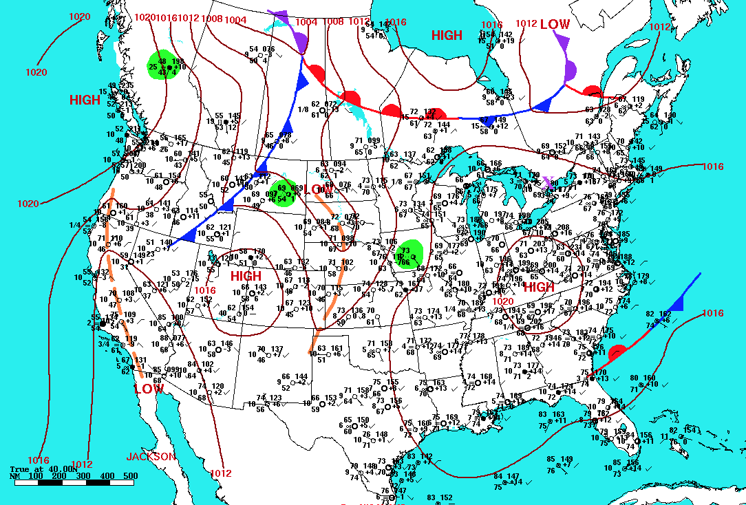
Image courtesy of NOAA: http://www.wpc.ncep.noaa.gov/dailywxmap/
Interpretation Tips:
- A high pressure region is centered over Kentucky, with weaker high pressure extending across the Great Lakes and Toronto.
- Low pressure in Quebec, with warm (plotted in red), cold (blue), and occluded (purple) fronts.
- Fog observed at many stations near the Great Lakes.
UBC ATSC 113 Weather for
Sailing, Flying & Snow Sports
Copyright © 2017 by Roland Stull
Last modification: May 2017
.